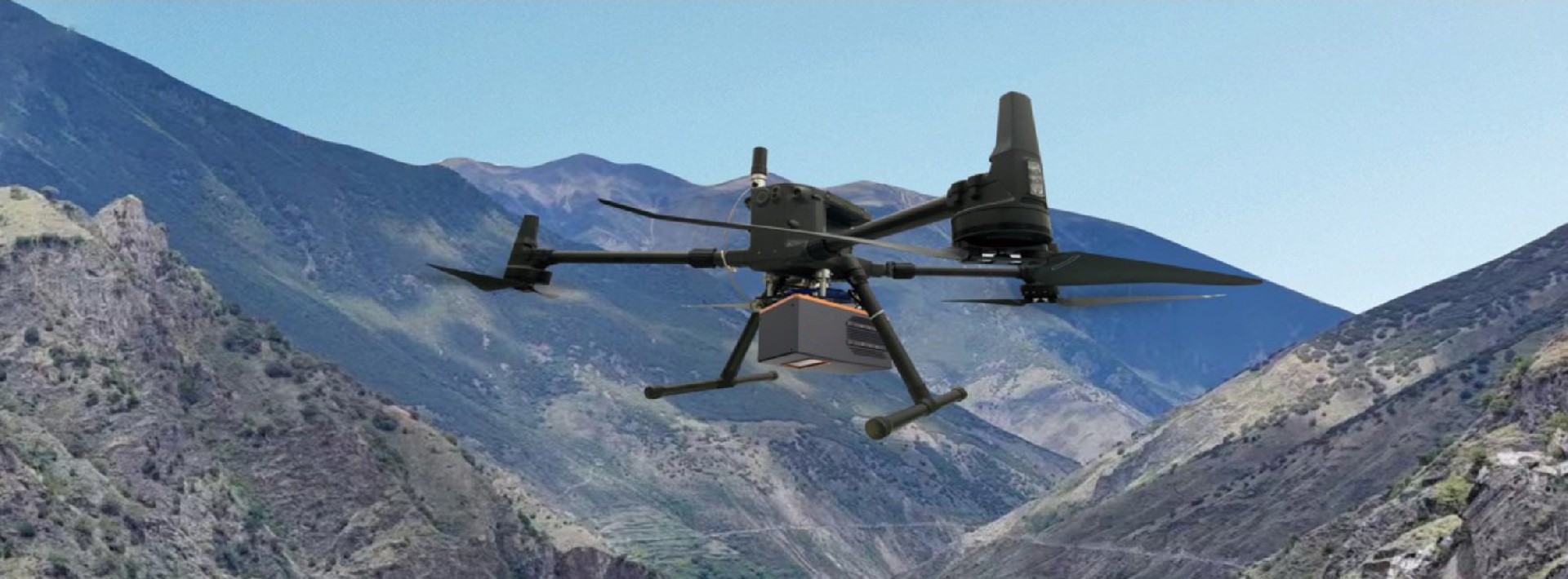

FT1500 is the first generation of long-range, high-precision, lightweight airborne LiDAR system. It can measure distances up to 1500m, weighs only 2.9kg, and features up to 7 returns (customizable to unlimited returns). The system is highly integrated, compatible with various load-carrying platforms such as VTOL fixed-wing UAVs, multi-rotor UAVs, helicopters, and unmanned boats. Equipped with independently developed point cloud fusion software, it provides integrated solutions for a variety of application needs. The FT1500 LiDAR can be widely used in topographic surveying, power line inspection, mining measurement, shoreline measurement, emergency surveying, natural resource investigation, and real-world 3D modeling, among other fields.
Advantages
Higher accuracy
Longer range measurement
Faster frequency
Stronger penetration
Specifications
Optical Parameters | Laser Class | Class 1 |
Wavelength | 1550nm | |
Laser Beam Divergence | 0. 5mrad | |
Measuring Range | 10m~1500m@80% | |
Laser Pulse Repetition Rate | 100k~2000K | |
Field of View | 75 ° | |
Angular Resolution | 0.001° | |
Measurement Technique | Phase Pulse Modulation | |
Scan Speed | 50~300 Scans/Sec | |
Laser Parameters | Relative Precision | 5mm@100m |
Max Number of Targets Per Pulse | 7 (Customizable Unlimited Times) | |
Echo Signal Intensity | 8bit | |
POS | IMU Accuracy (RMS) | (R; P; H) : 0.003°; 0.003°; 0.01° |
Location Accuracy | 1cm+1ppm | |
Size | Weight | 2.6kg |
Main Dimensions | 220*130*126mm | |
Work Environment | Operating Temperature Range | -20°C~ +55°C |
Storage Temperature Range | -40°C~ +70°C | |
Light Condition | Natural Light | |
Humidity | No Condensing | |
Protection Class | IP64, Dust and Splash-proof | |
Power | Power Supply Input Voltage | 24VDC (20V~32V) |
Power Consumption | <60W | |
Data Interfaces | TCP/IP | Gigabit network |
Synchronization | PPS signal(TTL level) | |
GNSS Time Signals | GPRMC signal(TTL leve |
Case Point cloud
Multi-Rotor Aircraft(Battery Life 50min Ground speed10m/s) | |||
AGL(m) | Density(pts/㎡) | Frequency(Khz) | Operation Area (k㎡) |
100 | 1738 | 2000 | 3.5 |
200 | 434 | 1000 | 7.0 |
300 | 260 | 900 | 10.5 |
400 | 108 | 500 | 14 |
500 | 87 | 500 | 17.5 |
VTOL(Battery Life 120min Ground speed28m/s) | |||
AGL(m) | Density(pts/㎡) | Frequency(Khz) | Operation Area (k㎡) |
200 | 308 | 2000 | 46.8 |
300 | 92 | 900 | 70.2 |
400 | 38 | 500 | 93.6 |
500 | 30 | 500 | 117 |
CASES
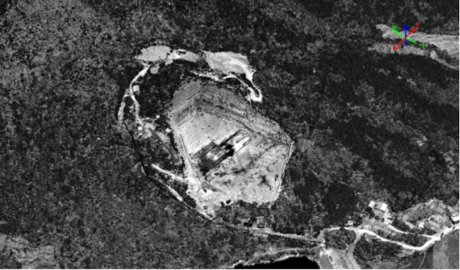
Mountainous Terrain Mapping
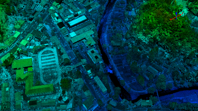
Acquiring terrain data for an approximately 3.5 square kilometer mountainous area. The terrain in the mountainous area is complex, and it is largely covered with dense forests, making manual surveying difficult and inefficient. The DEM results are generated based on high-precision LiDAR measurement data.
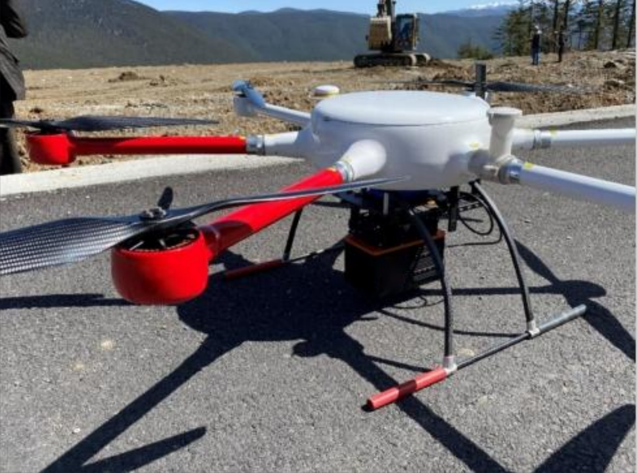
Equipment Used: FT1500, Multi-rotor Drone
Work Flow:
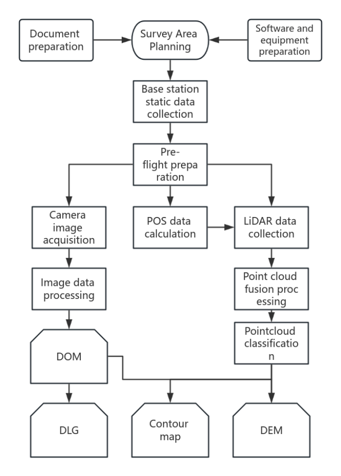
Project Results
Raw point cloud&True color point cloud
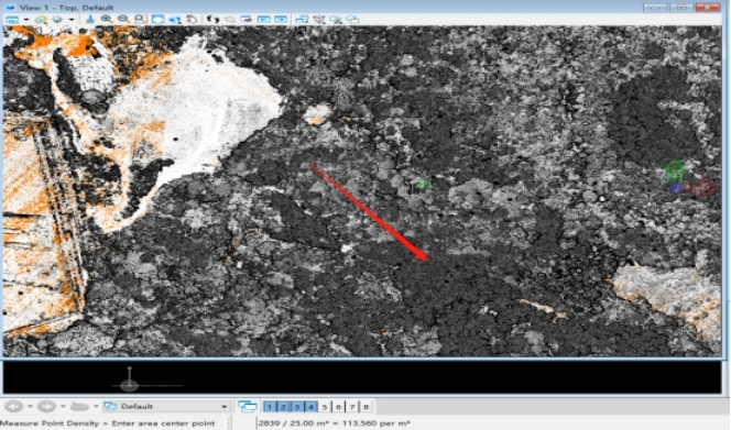
Point cloud density:113per ㎡
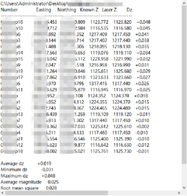
Elevation accuracy:RMS 2.8cm
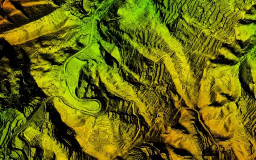
DEM
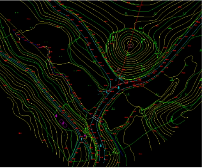
Contour
Traditional surveying methods, primarily total stations and GPS-RTK, have limitations such as low efficiency, incomplete information, and safety risks. Airborne LiDAR technology offers flexible and convenient operations with minimal impact from environmental conditions. It provides faster surveying speeds and higher efficiency, significantly reducing fieldwork time. The data quality is higher, with dense point clouds and improved mapping quality, all while substantially lowering labor costs.