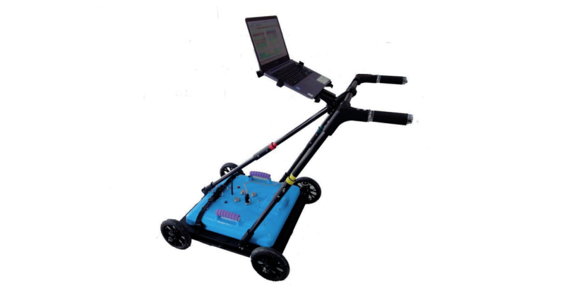
LGPR-MFC Multi-frequency 3D Wireless Ground Penetrating Radar adopts multi-frequency fitting technology, with high frequencies using 400MHz/600MHz/750MHz/900MHz and low frequencies using 200MHz/250MHz. It integrates antennas of two different center frequencies into a single probe. Compared with a single probe, it can simultaneously meet the requirements of detection depth and resolution. A single scan can detect both shallow-buried small-diameter pipes and deep-buried large-diameter pipes, with a small overlap in the effective frequency range of the two antennas, thus increasing the effective frequency coverage. This not only improves the detection efficiency but also greatly enhances the identification rate of pipelines through the comparison of detection data from high and low-frequency antennas.
Advantages
Integrated design, the main unit and antenna are combined.
Equipped with a GPS data interface for real-time pipeline positioning.
High and low-frequency combined antenna to improve work efficiency.
Quick mark-back positioning to locate pipeline positions.
Specifications
Antenna Frequency | Main composite frequencies are 200&400MHz, 200&600MHz, 250&750MHz, 250&900MHz. Supports dual-frequency simultaneous operation or individual use. |
Number of Channels | 2 channels, the main unit supports up to 16 channels. |
Number of Sampling Points | 512, 1024, 2048, 4096, 8192 adjustable. |
Detection Depth | Maximum detection depth ≥5m (depending on different media). |
Acquisition Rate | 1-480 scans/second, selectable. |
A/D Bits | 16 bits. |
Dynamic Range | ≥178dB. |
Display Modes | Pseudocolor map, stacked waveform diagram, continuous measurement. |
GPS | Compatible with mainstream brand GPS/RTK for data frame synchronous display. |
Acquisition Speed | Maximum 25km/h. |
Operating Temperature | -10℃~+50℃. |
Storage Temperature | -40℃~+70℃. |
System Power Consumption | 13.3W. |
System Power Supply | Lithium battery 12V DC, 12AH. |
Protection Level | IP65. |
Dimensions | 50cm50cm35cm. |
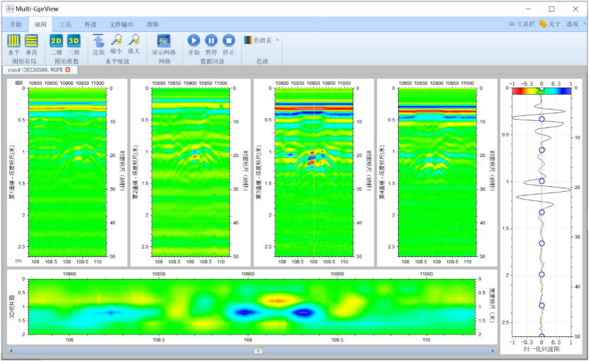
Standard Model Test Result Chart
Cases
Shield Tunnel Segment Grouting Quality Detection: LGPR-MFC (600MHz & 900MHz)
Ground Penetrating Radar (GPR) is favored for its high resolution, rapid speed, and non-destructive operation. It can efficiently and non-destructively inspect the quality of shield tunnel segment grouting, primarily focusing on the grouting density and defect detection to evaluate the quality of the grouting work.
The dual-frequency radar, with its multi-band composite technology, balances the high resolution of the high-frequency band with the greater depth penetration of the low-frequency band. It can simultaneously reveal information about both the deeper and shallower parts and is equipped with a 3D slicing display function, making anomalies more visually intuitive.
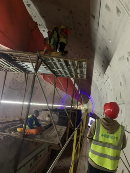
Shield Tunnel Subway Tunnel Inspection Site
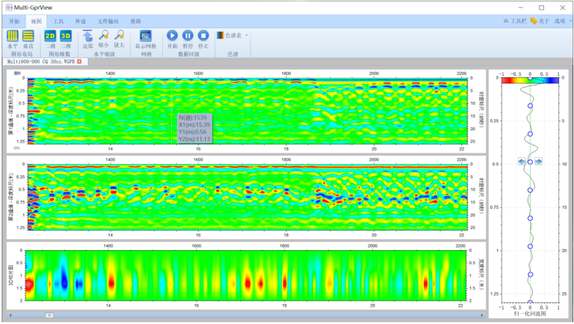
Detection Result Image
Highway Subgrade Inspection
The road to be tested has an asphalt surface, with an unknown thickness of the asphalt layer. Excavation for on-site verification is carried out immediately after the detection is completed. A 400MHz Ground Penetrating Radar (GPR) is used, mounted on a portable trolley. When testing on the asphalt surface, the LGPR time window is set to 47.84ns, and the measurement range is set to 2 meters. Gain curves and other parameters are automatically set by the software.
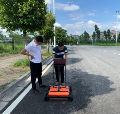
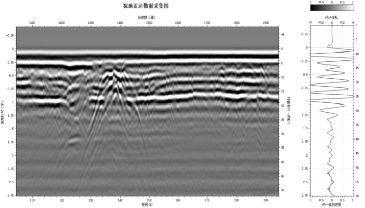
Based on the data obtained from the Ground Penetrating Radar, we can draw the following conclusions:
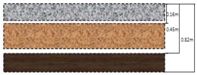
1) The thickness of the asphalt layer ranges from 0.12 to 0.16 meters.
2) The base layer depth is 0.4 to 0.45 meters.
3) The depth of the sub-base layer in the test section is 0.73 to 0.82 meters.
4) Based on the data from the test, structural information about the road foundation in the test section can be obtained.
GprView
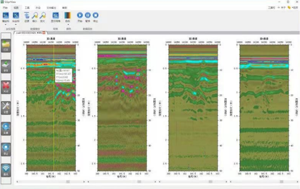
Radar waveform parameters can be dynamically adjusted, such as: time window, signal position, number of sampling points, etc.
Three operating modes are available: point-by-point measurement, distance-triggered measurement, continuous measurement.
Real-time filtering, real-time overlay noise reduction, automatic gain adjustment.
Data is stored in real time and can be played back and printed out afterwards.
WaysView
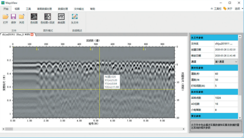
The Ground Penetrating Radar data analysis system WaysView is a new generation of Ground Penetrating Radar data processing platform. It is user-friendly, offers higher clarity, and is a specialized data processing and analysis software for the WGPR series of Wireless Ground Penetrating Radars. This software provides standard processing functions for general geological radar data analysis, such as signal filtering, background removal, gain adjustment, Laplace filtering, layer tracking, distance normalization, data offset, etc. It also offers users a general data processing workflow. Following this workflow allows for the easy completion of data processing and the generation of results, enabling even beginners to quickly carry out data collection and processing.