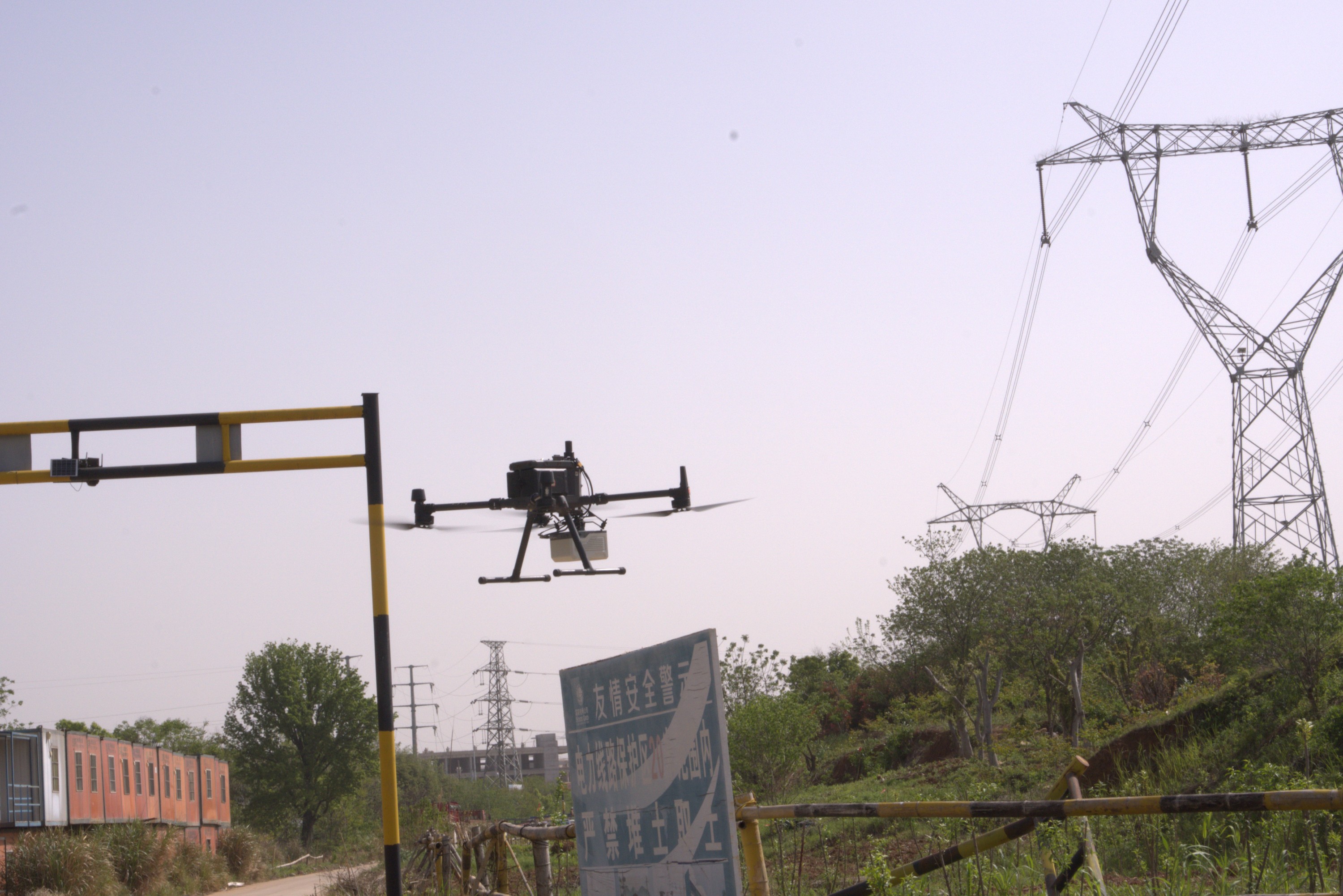
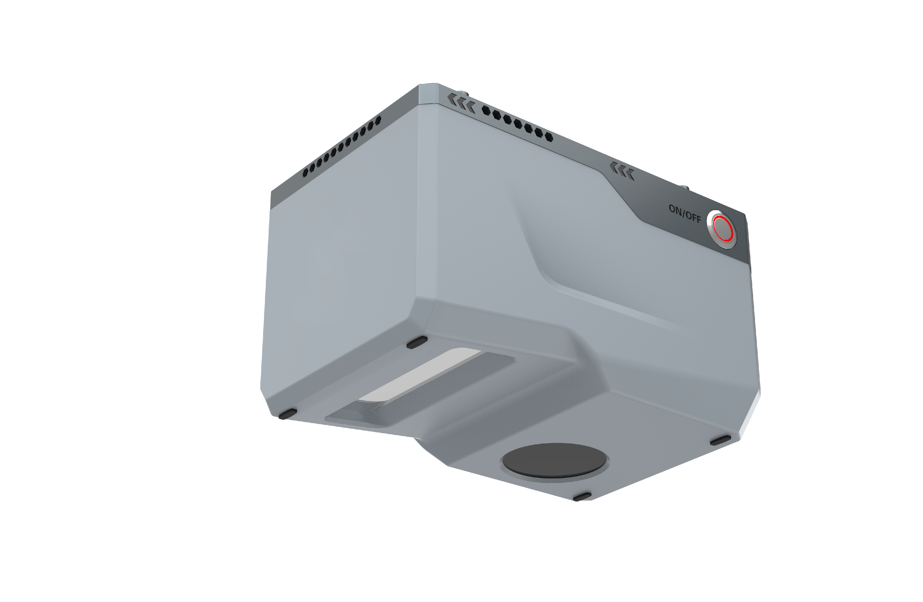
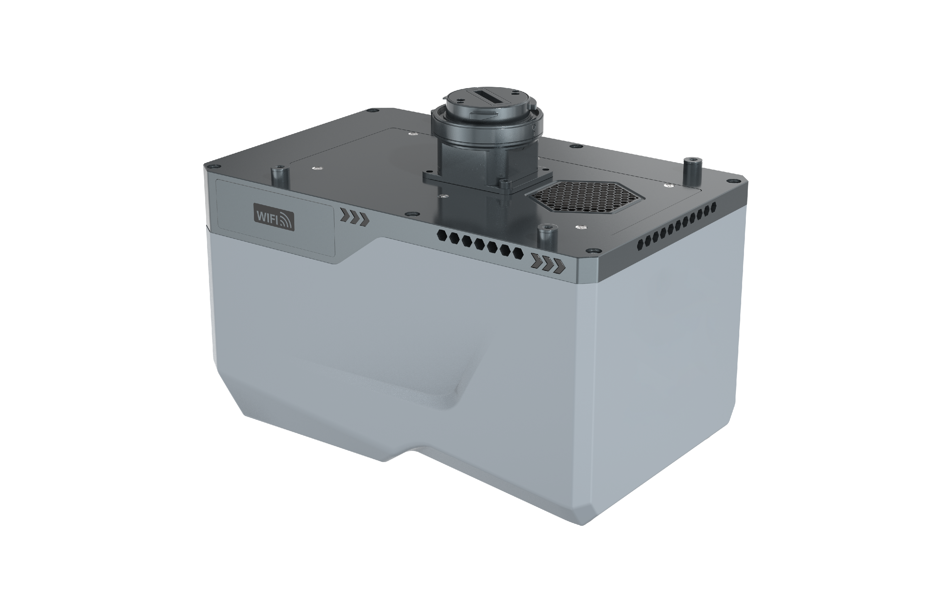
The all-in-one UAV-based airborne mapping system employs a compact and lightweight design to deliver survey-grade performance. It integrates a built-in aerial metric camera, high-precision inertial navigation system (INS), and a LiDAR sensor with mm-level accuracy.
Specifications
System Parameter | Weight | 1.35kg |
Dimensions | 179*116*106.9mm (L*W*H) | |
System Accuracy | Horizontal 5cm;Elevation 4cm | |
Operating Temperature | -20℃~ +50℃ | |
Light Condition | Natural Environment | |
Humidity | Non-condensing | |
Protect Level | IP64 | |
Data Storage | 512GB | |
Power Supply Input Voltage | 24VDC(20V~30V imput range) | |
Power Consumption | 50W | |
Lase Scanner | Laser Class | Level 1 |
Laser Wavelength | 1535nm | |
Beam Divergence | 0.5mrad | |
Measurement Range | 10~750m@80%; 10~350m@20% | |
Laser Pulse Repetition Rate | 100k~550K | |
FoV | 80° | |
Angular Measurement Resolution | 0.001° | |
Ranging Method | ToF | |
Scan Rate | 300 lines/sec | |
Repeatability Accuracy | 5mm@100m(1σ) | |
Number of Returns | 7 times (typical value) | |
Echo Signal Intensity | 8bit (Radiometric Calibration) | |
POS | Positioning Accuracy | Roll/pitch:0.005° |
Heading:0.01° | ||
Horizontal Positioning Accuracy | 0.01m | |
Vertical Positioning Accuracy | 0.02m | |
Aerial Camera | Pixels | 45MP/26MP(Optional) |
Integrated Design · Ultra-Light Deployment
Laser, IMU, camera, and storage modules are seamlessly integrated into a single unit, with a total system weight of just 1.35 kg. The result is a truly lightweight solution that is portable, efficient, and highly adaptable in the field.
Mid-to-Long Range · Accurate and Reliable
The system supports a maximum range of up to 750 meters, with repeatable ranging accuracy better than 5 mm within 100 meters—delivering precise measurements across diverse scenarios.
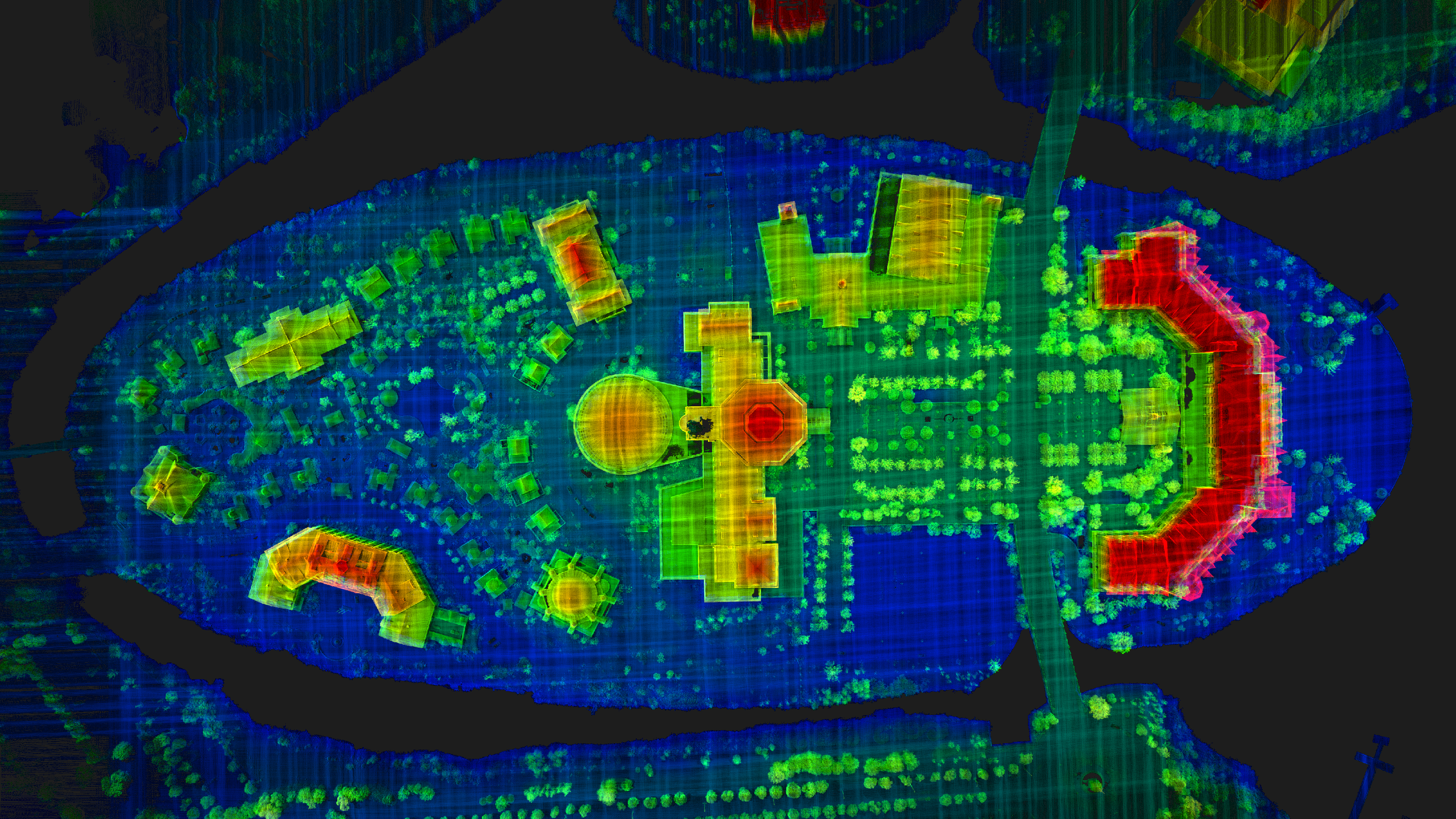
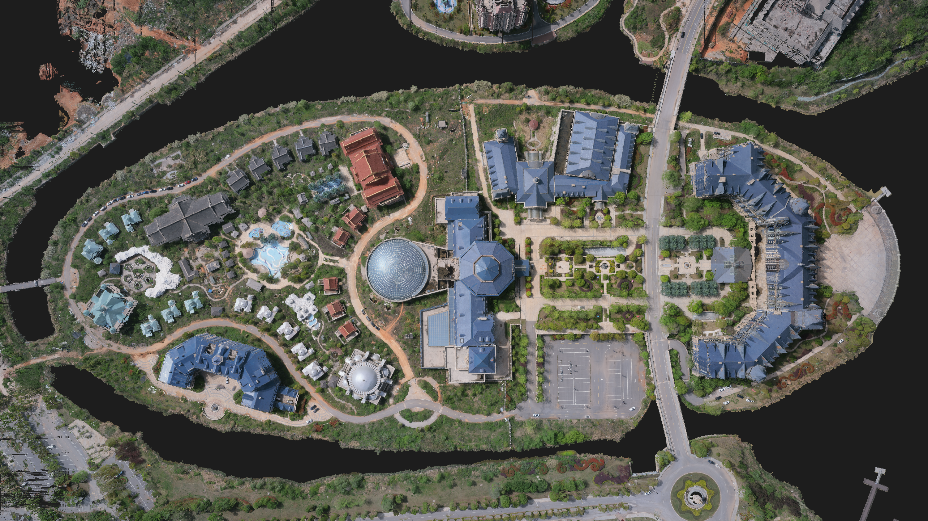
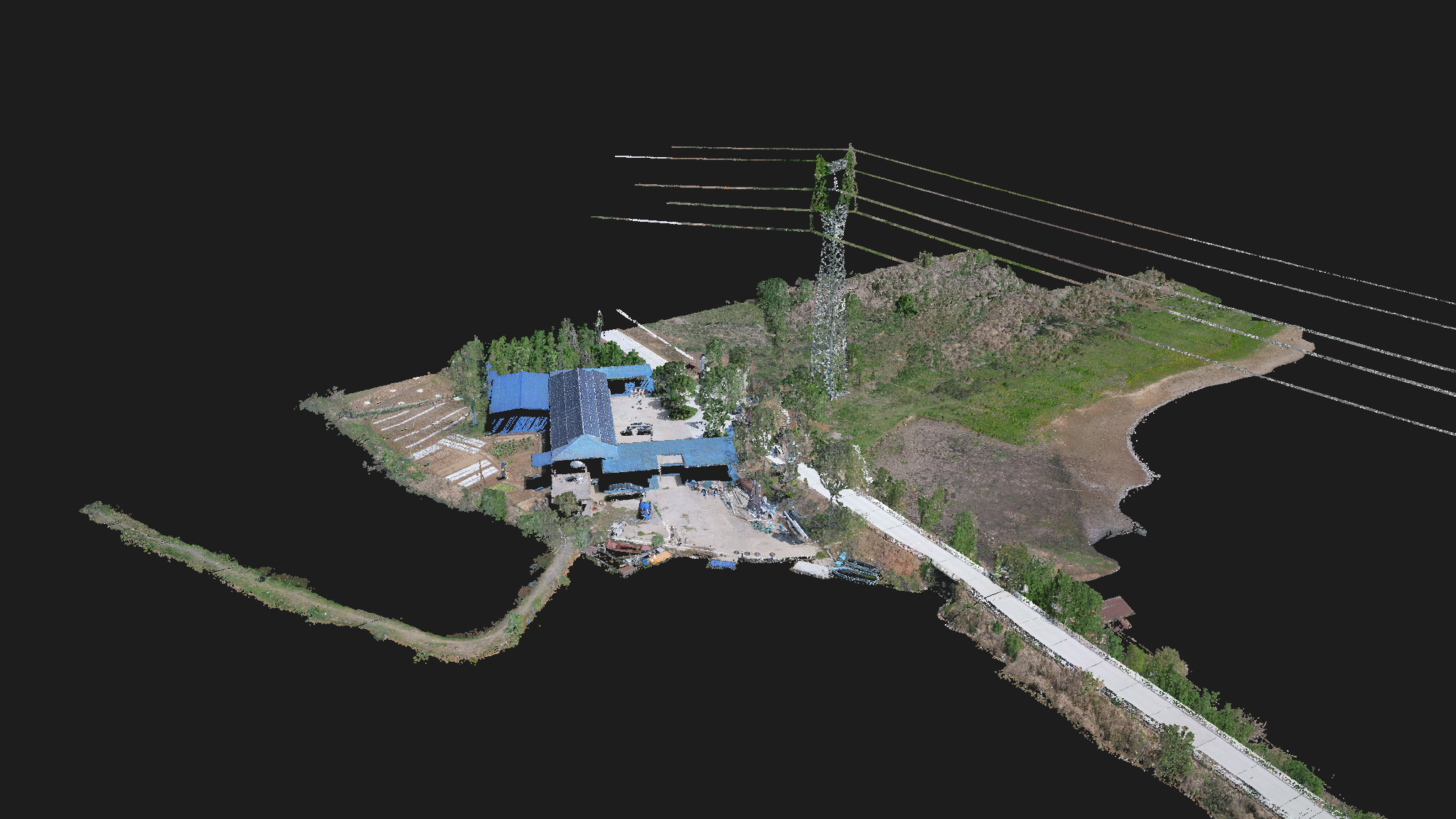
High Performance · Detailed Point Clouds
Featuring a rotating prism laser design, the system offers an 80° horizontal field of view, a laser divergence angle of 0.5 mrad, and a point frequency of up to 550 kHz—enabling dense and highly detailed 3D data acquisition.
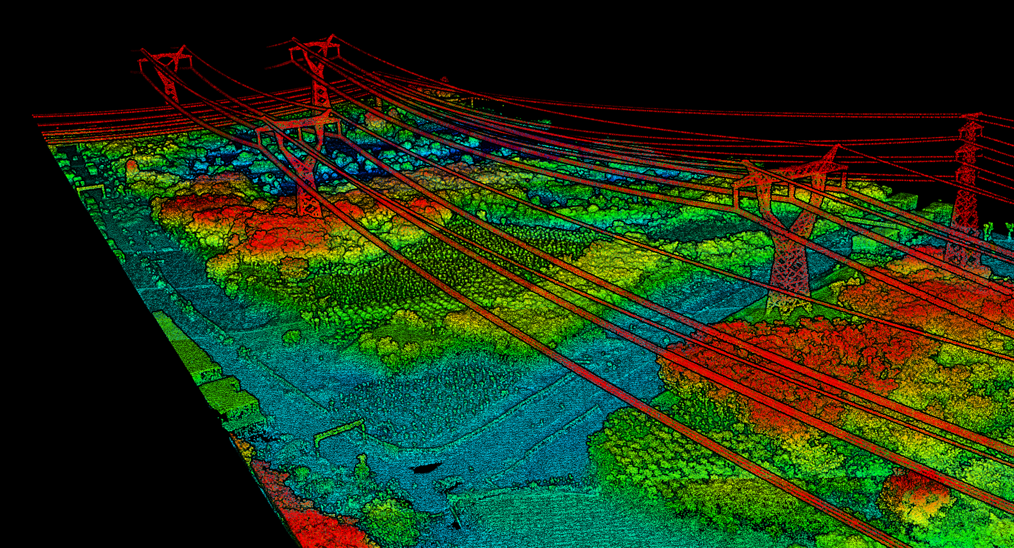
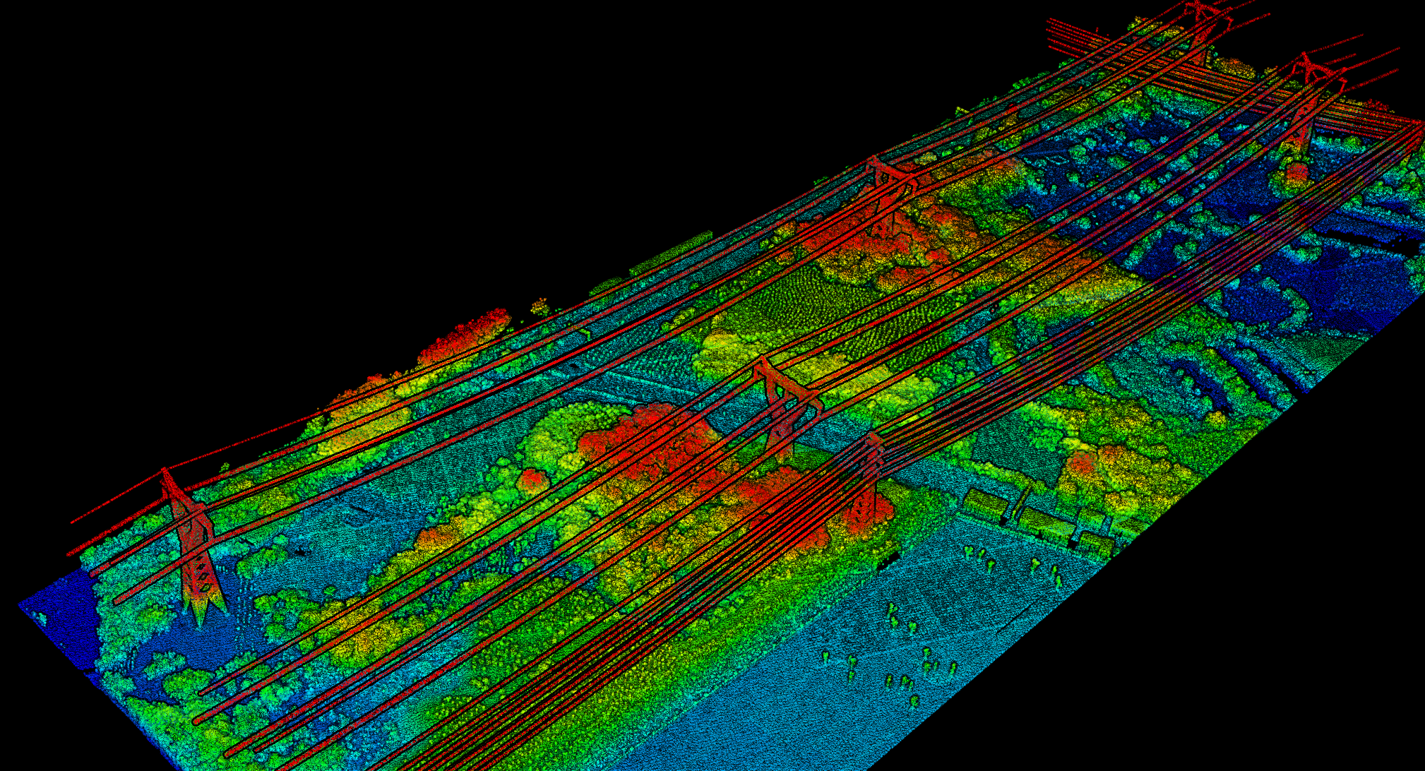
Vegetation Penetration · True Terrain Mapping
With unlimited echo detection, the system can effectively penetrate dense vegetation, capturing complete and accurate terrain data beneath forest canopies for comprehensive topographic reconstruction.