SpaceVoxelProcessor is a high-performance remote sensing data processing platform designed for rapid, large-scale image manipulation . Built on automated algorithms optimized for CPU/GPU clusters, it efficiently handles multi-source, medium-to-high-resolution satellite imagery.
The software delivers standardized workflows for generating processing-ready datasets and analysis products, with integrated quality control at every stage. Its scalable architecture supports both profes sional and commercial applications in geospatial analytics.
Key Technologies
High-Performance Parallel Image Processing:
Utilizes a heterogeneous CPU-GPU cluster to enable parallel task execution, greatly enhancing image processing efficiency.
Large-Scale Regional Network Adjustment:
Applies adaptive weighting, virtual observation constraints, and automatic anomaly detection to adjust multi-source satellite imagery with minimal ground control.
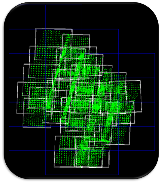
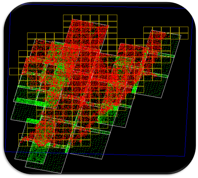
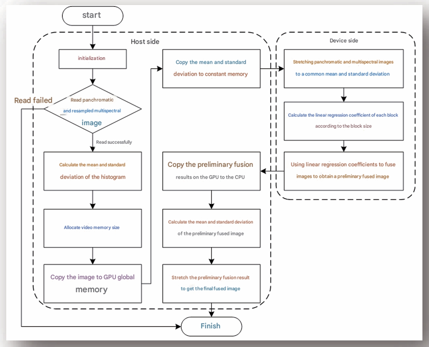
Image Fusion Technology:
Provides multiple image fusion methods, resulting in clear textures and full colors; GPU Parallel Processing of the Improved PanSharpen Fusion Algorithm uses the minimum variance technique to perform optimal matching on the bands involved in fusion, ensuring that the fused image is color consistent with the multispectral image and has almost no color deviation.
Key Technologies
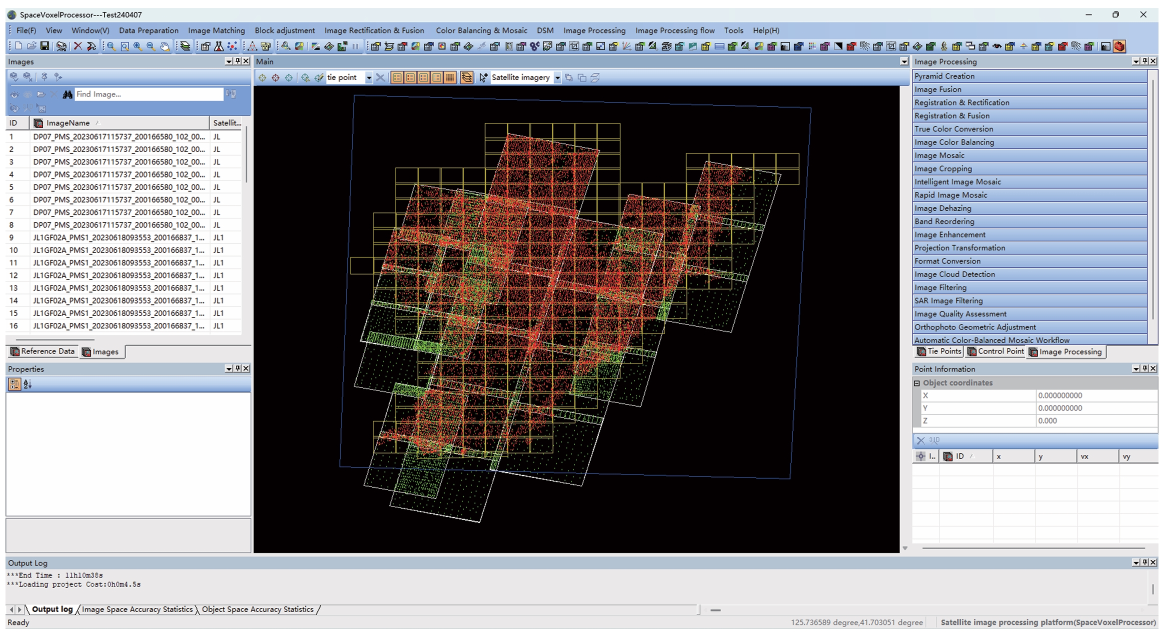
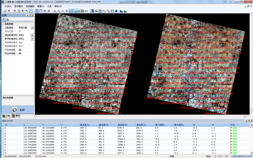
Image Registration Technology:
Offers fast, high-precision automatic matching across multi-source and multi-temporal images with rotation distortion. Robust error elimination ensures sub-pixel accuracy.
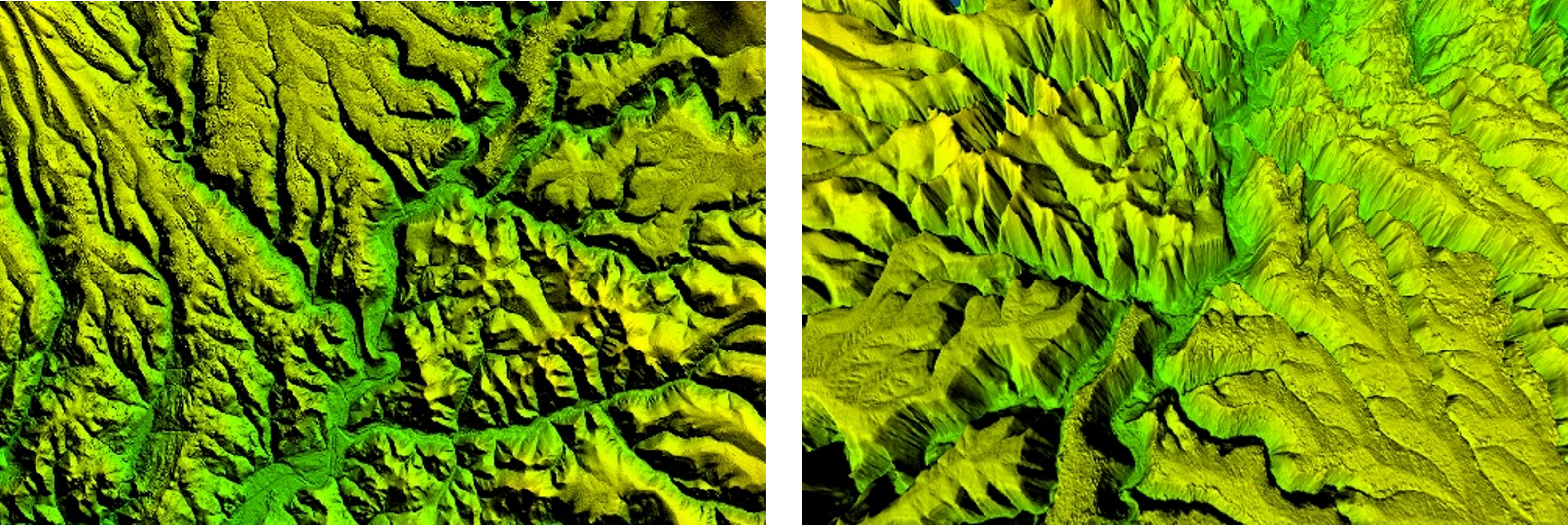
DSM Dense Matching Technology:
Uses multi-view dense matching and sub-pixel optimization to generate high-precision terrain data. Automatic error elimination enhances accuracy, making it ideal for detailed mapping and 3D urban reconstruction.
Color Balancing Technology:
Provides multiple schemes to correct inter nal color anomalies and inter-image differ ences, ensuring true-to-life tones and smooth, natural transitions across various scenarios.
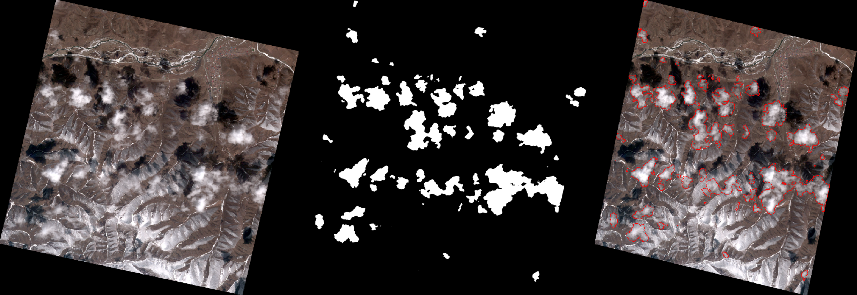
Automatic Cloud Detection Technology:
This methodology employs a hybrid approach integrating advanced image processing techniques with deep learning algorithms to perform accurate cloud detection in optical remote sensing imagery.
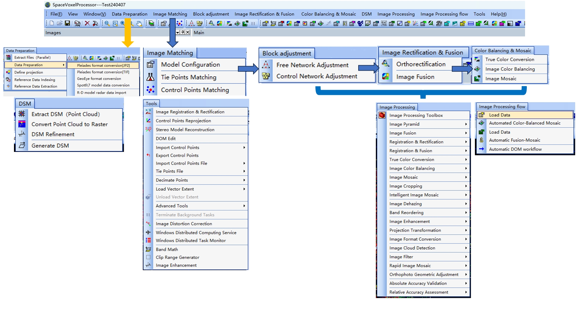
Features
Provide efficient image processing algorithm modules
This SW delivers comprehensive remote sensing processing capabilities, including:
Core Functions:
Image inspection & correction (cloud detection, registration, color balancing)
Advanced processing (fusion, true color conversion, DSM/DEM generation)
Data optimization (projection/band/format conversion, pyramid creation)
Specialized Tools:
Image enhancement (dehazing, filtering)
Feature extraction (vegetation, water bodies)
Quality control & output (cropping, embedding, QA)
Intuitive Data Interaction Tools
Designed around professional workflows, the intuitive interface integrates tools for registration, viewing, stereo analysis, and quality inspection for smooth operation.
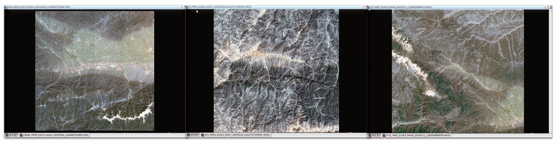
Support various remote sensing satellite constellations
The system supports multiple imagery from mainstream remote sensing satellites, which including optical and SAR, single images(panchromatic and multiple spectral ) or stereo pair.
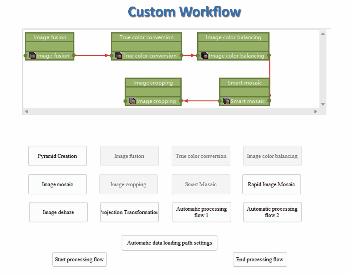
Automated Integrated Processing System and Predefined Workflow Template
The SW produces spatiotemporally compre hensive (Massive), multi-satellite collabora tive (Hybrid), and continuously updated (Rapid) standard data products. One click automatic processing (supports multiple workflows and custom workflow).
Support Multimode Parallel Computing
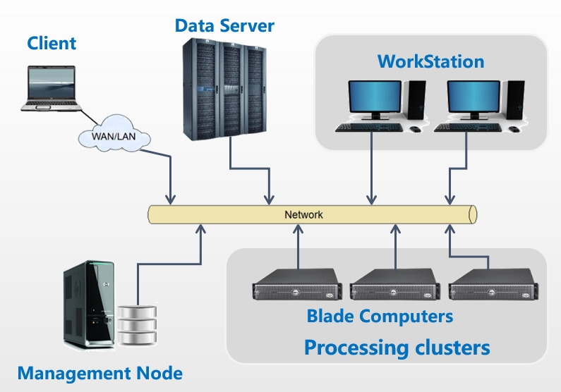
Enables high-performance computing across multi-core CPUs, GPUs, and heterogeneous clusters (PCs, workstations, servers). Cross-platform and OS/architecture compatible.
Applications
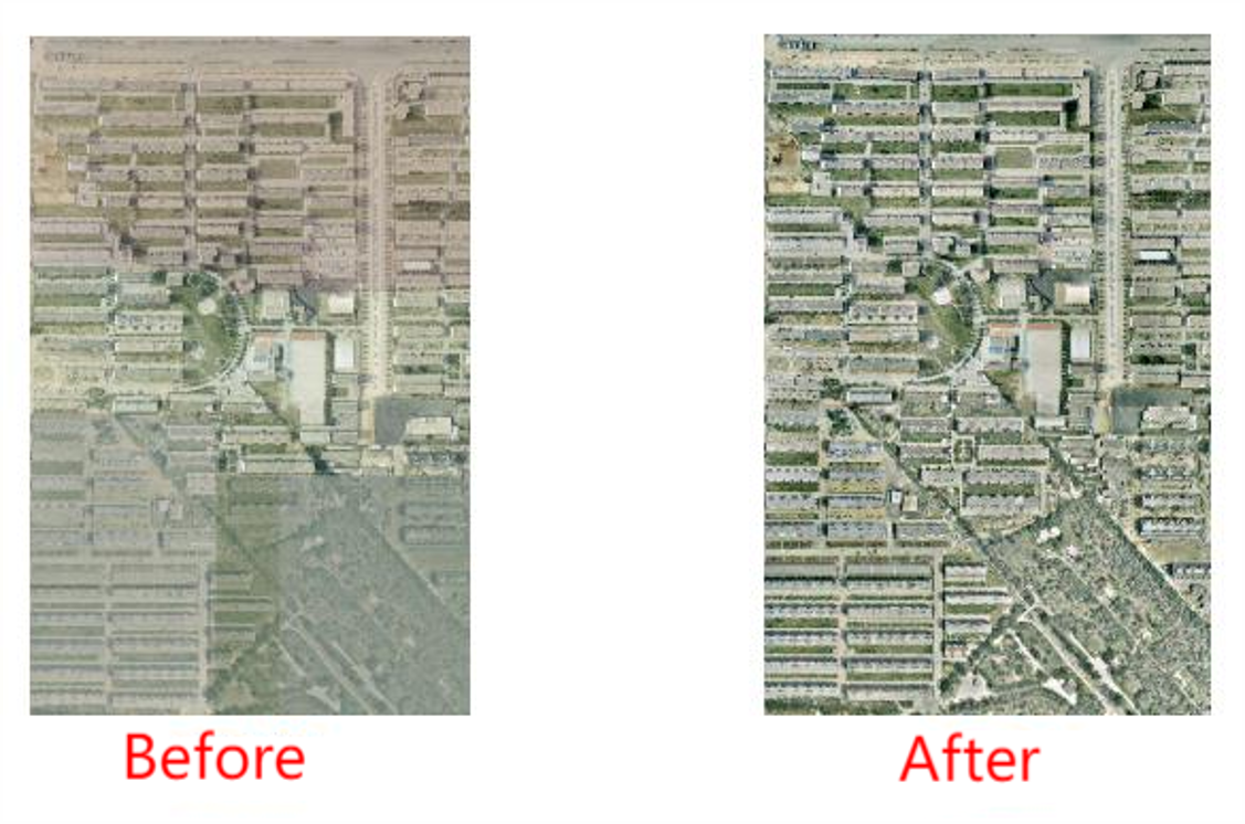
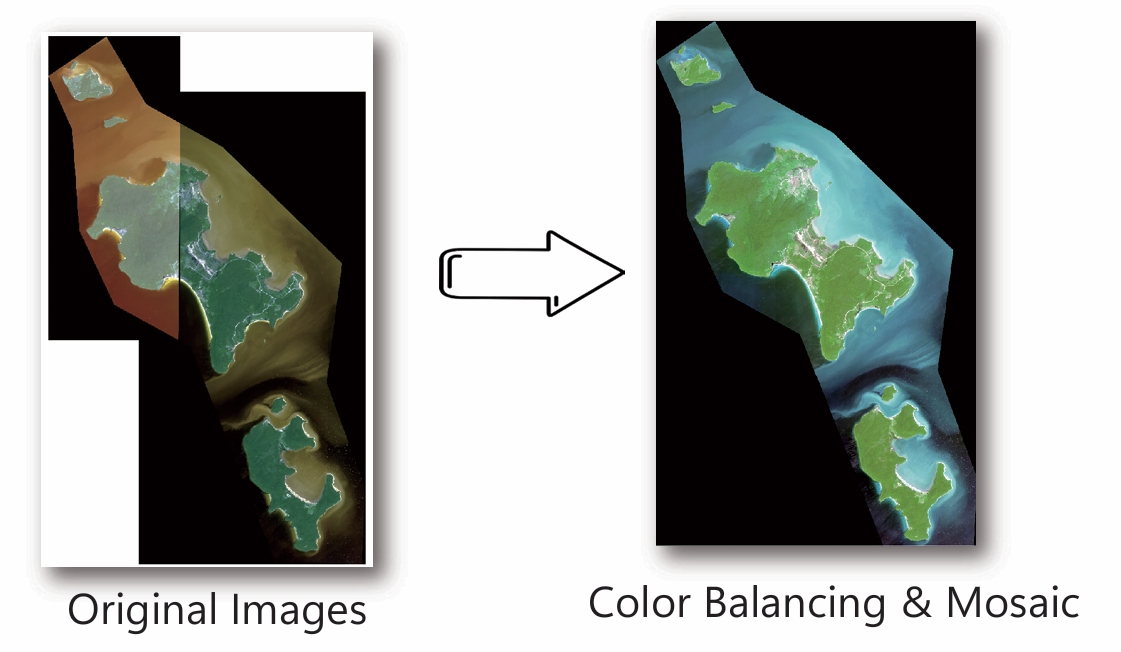
Automatic Image Color Balancing & Mosaic Generation
Koh Rong island Image from WorldView
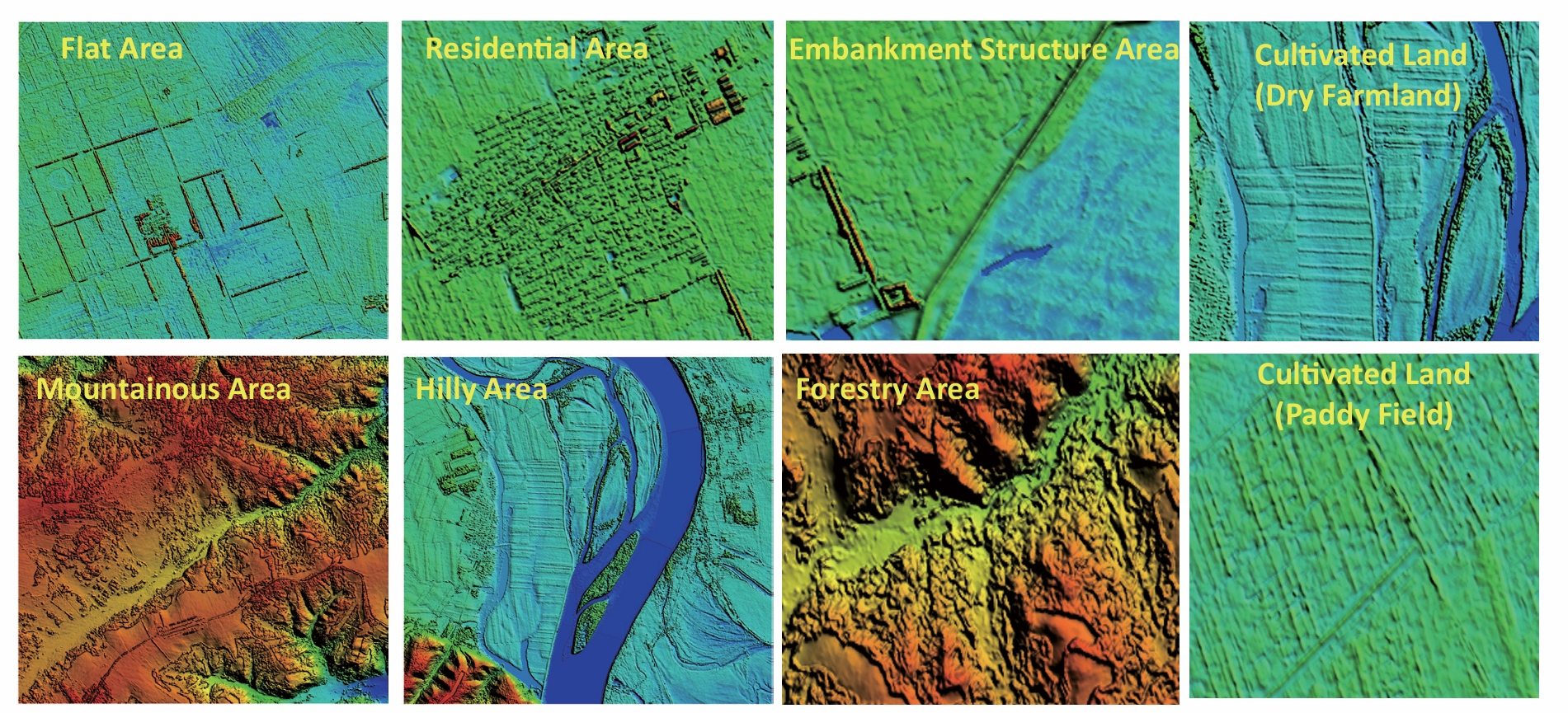
Automatic DSM Matching
DSM Hillshade Map from SuperView