
Recently, Linventix’s remote sensing data processing software SpaceVoxelProcessor has officially been launched on the GeoCloud software ecosystem platform, providing global users with more efficient and convenient remote sensing data processing and analysis services.
SpaceVoxelProcessor is a high-performance remote sensing data processing platform designed for rapid, large-scale image manipulation. Built on automated algorithms optimized for CPU/GPU clusters, it efficiently handles multi-source, medium-to-high-resolution satellite imagery.
The software delivers standardized workflows for generating processing-ready datasets and analysis products, with integrated quality control at every stage. Its scalable architecture supports both professional and commercial applications in geospatial analytics.
Main features:
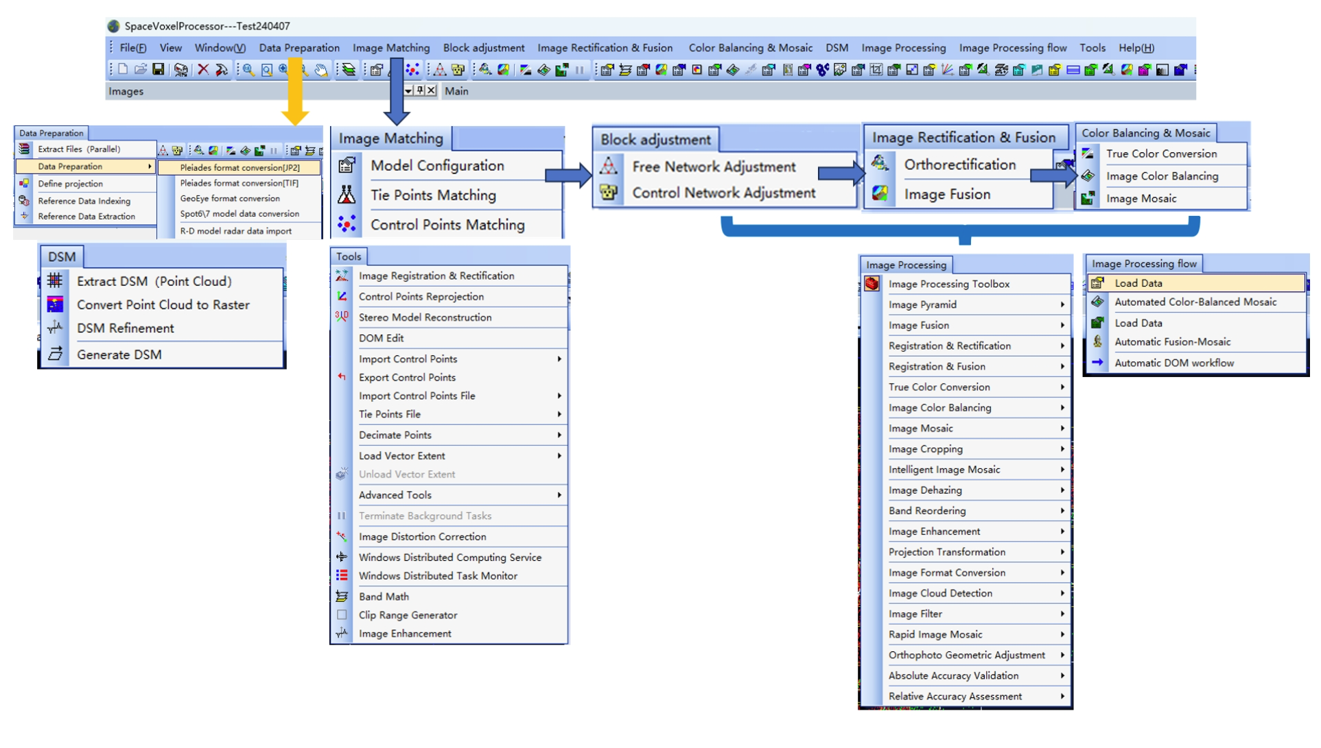
· Complete satellite imagery processing
• Automatic Tie Points/ Control Points Collection
• Automatic Block Adjustment
• Automatic DSM/DTM Creation & Editing
• Automatic Orthorectification
• Automatic Pansharpening
• Automatic True Color Conversion
• Automatic Color Balancing and Mosaicking
• Automatic Cloud, Snow, and Blunder Distortion Replacement for Orthophoto
• Automatic Image Quality Assessment (raw satellite images and DOM)
• Automatic Cloud Detection
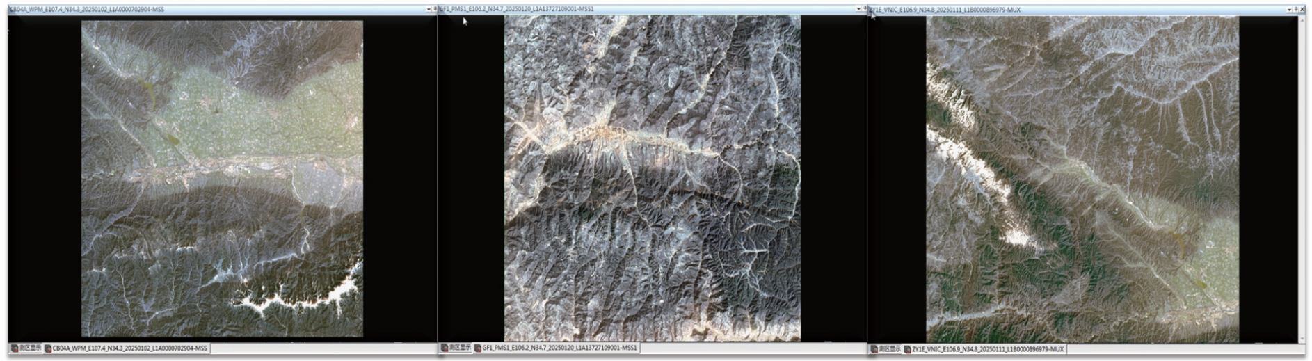
· Imagery supported
• SAR
• Optical: Panchromatic, Multispectral, RGB, B/W, CIR, NIR
· Imagery source: Satellite, Orthorectified aerial ortho.
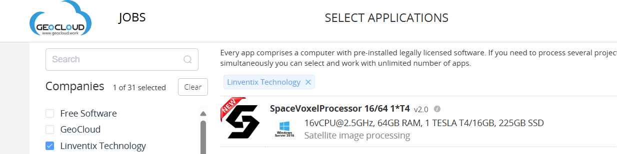
With its launch on GeoCloud, the accessibility and deployment of SpaceVoxelProcessor are further improved. Through the cloud platform, users can access and use the software with just one click—no installation required—enabling remote sensing data processing anytime, anywhere.
GeoCloud Ltd. is a cloud platform company, which focuses on providing cloud-based remote desktop software services, enabling users to access licensed software online without downloads or installation.
GeoCloud platform supports a wide range of professional software, including GIS (Geographic Information Systems), Remote Sensing, 3D Modeling, LiDAR Point Cloud Processing, Photogrammetry, Engineering Design (CAD, BIM), Geology, Rendering, and AI Recognition Tools.
Linventix stated:
“We hope that through our collaboration with GeoCloud, our self-developed software capabilities can serve a broader range of global industry users. In the future, we will continue to enhance performance, expand functional modules, and bring more innovations to geospatial data processing.”
Click the link to access SpaceVoxelProcessor on GeoCloud:👉GeoCloud · Linventix
