
Project Background
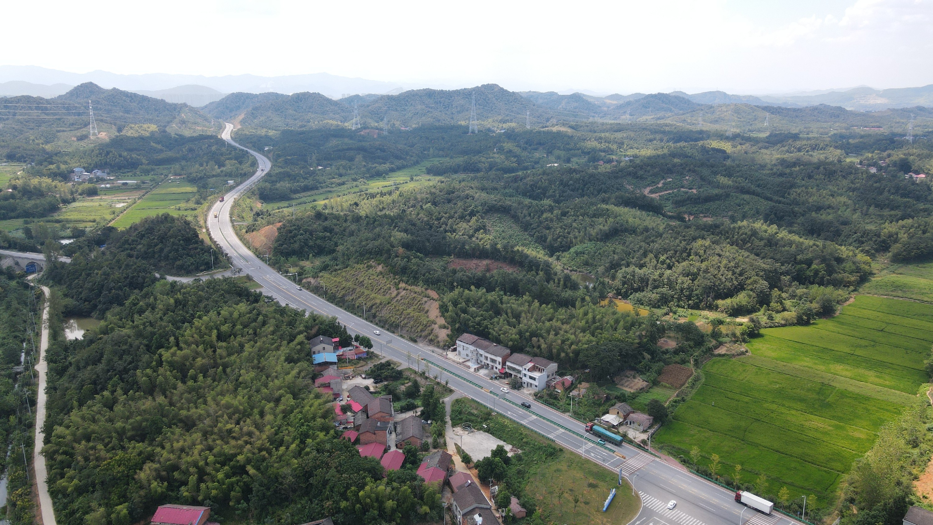
A mountainous secondary highway has experienced pavement cracking and collapse due to increasing traffic volume and heavy vehicles, requiring reconstruction and expansion. Traditional manual surveying is inefficient, time-consuming, and poses safety risks. Therefore, the client and the design team decided to adopt FT-mini airborne LiDAR to achieve rapid, high-precision mapping.
The Challenge
Terrain constraints: The mountainous road passes through steep slopes and dense forests, making it difficult for conventional total stations and GPS measurements to access. Base station setup points are limited, and communication is severely obstructed.
Traffic interference: Some sections are still in service with heavy traffic. Manual surveying requires prolonged road closures, increasing safety risks and impacting social operations.
Tight schedule: The client required submission of 1:500 topographic results within a very short timeframe for design and engineering calculations.
High accuracy requirement: Details such as slopes, drainage ditches, houses, and ground objects must be fully captured. Errors must be controlled within centimeters to avoid affecting subsequent construction design.
Unfavorable natural conditions: The survey area is covered with dense vegetation. Manual clearance is time-consuming and labor-intensive, and traditional surveying methods struggle to achieve full coverage.
Survey Objectives
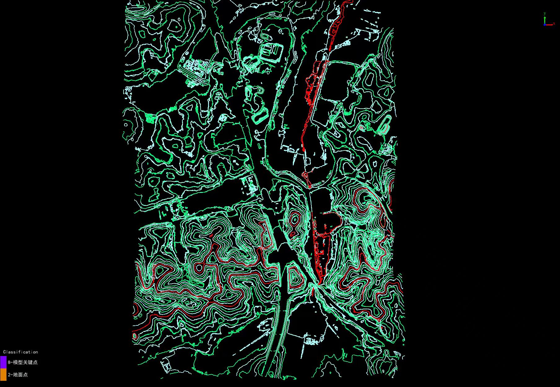
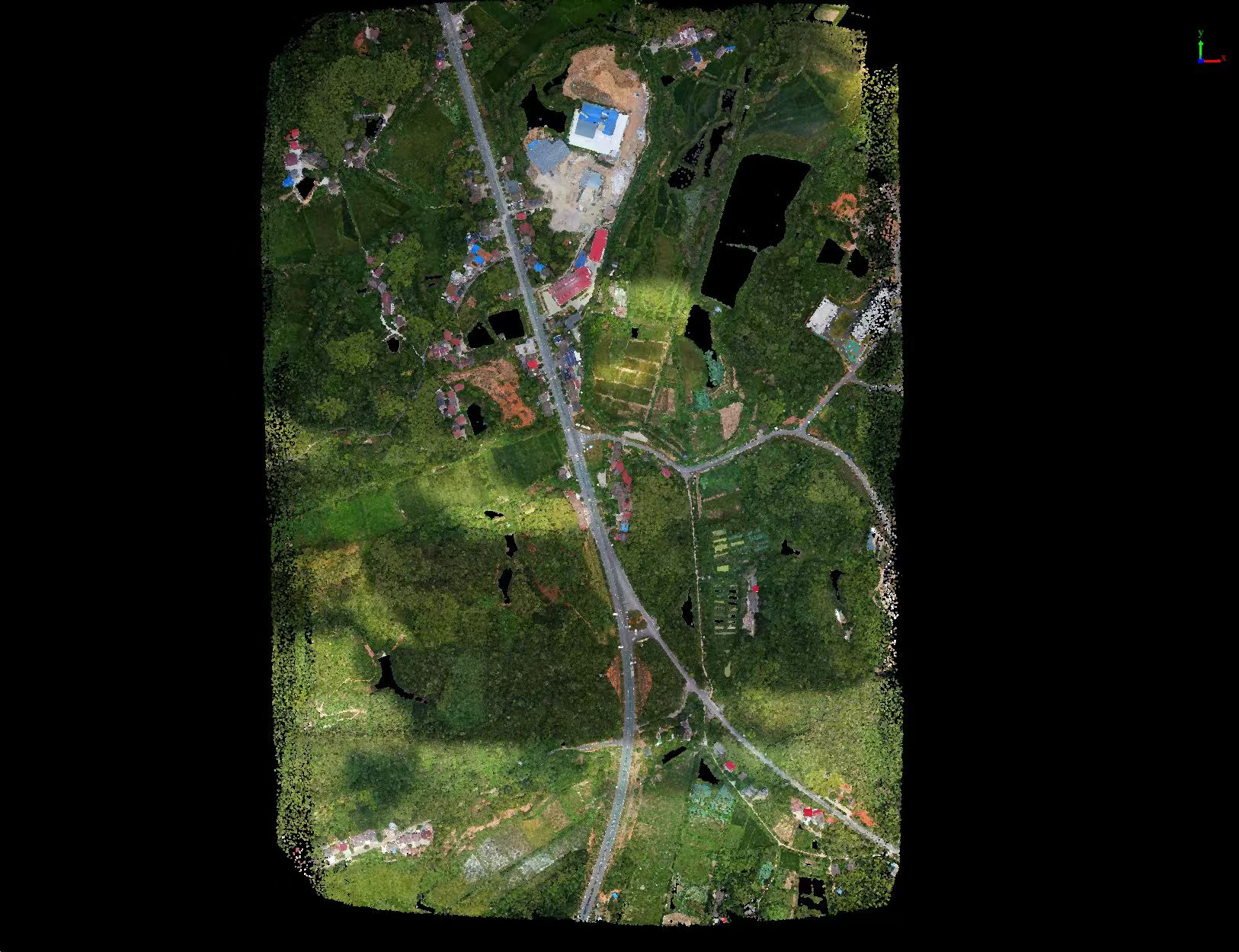
Acquire high-precision point clouds covering approximately 1.34 km².
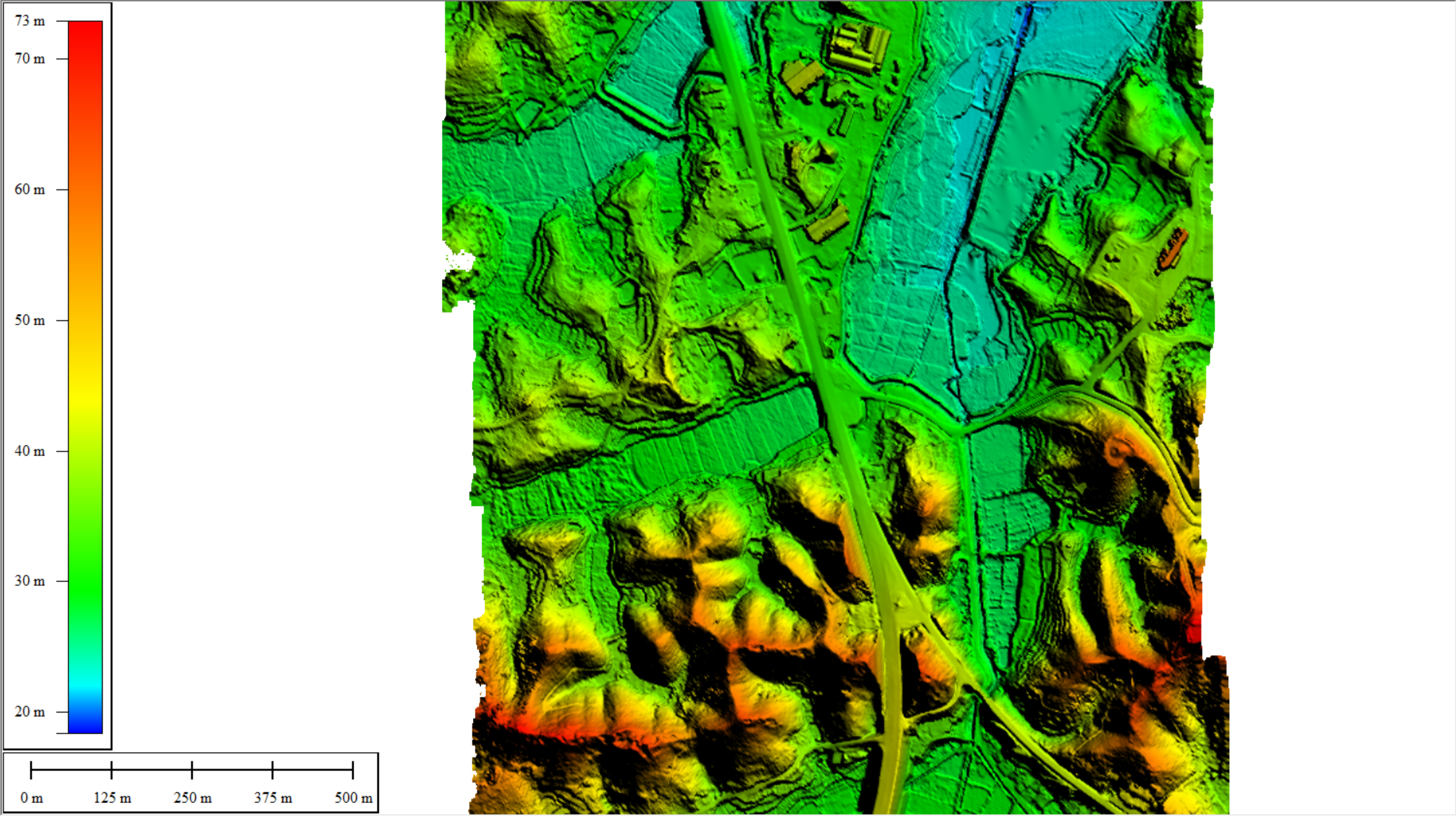
Generate a 1:500 Digital Elevation Model (DEM).
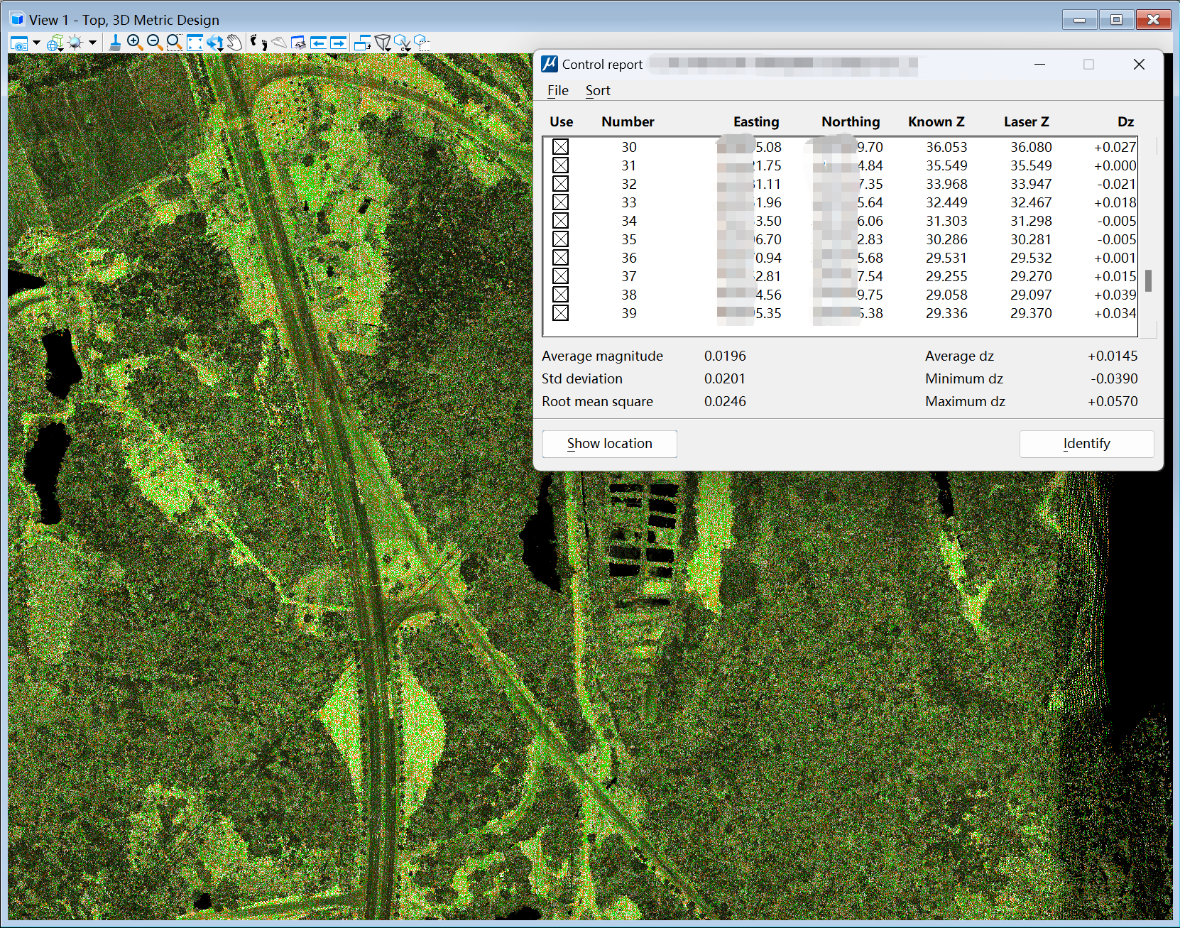
Provide an elevation benchmark with accuracy better than 3 cm.
Equipment & Parameters
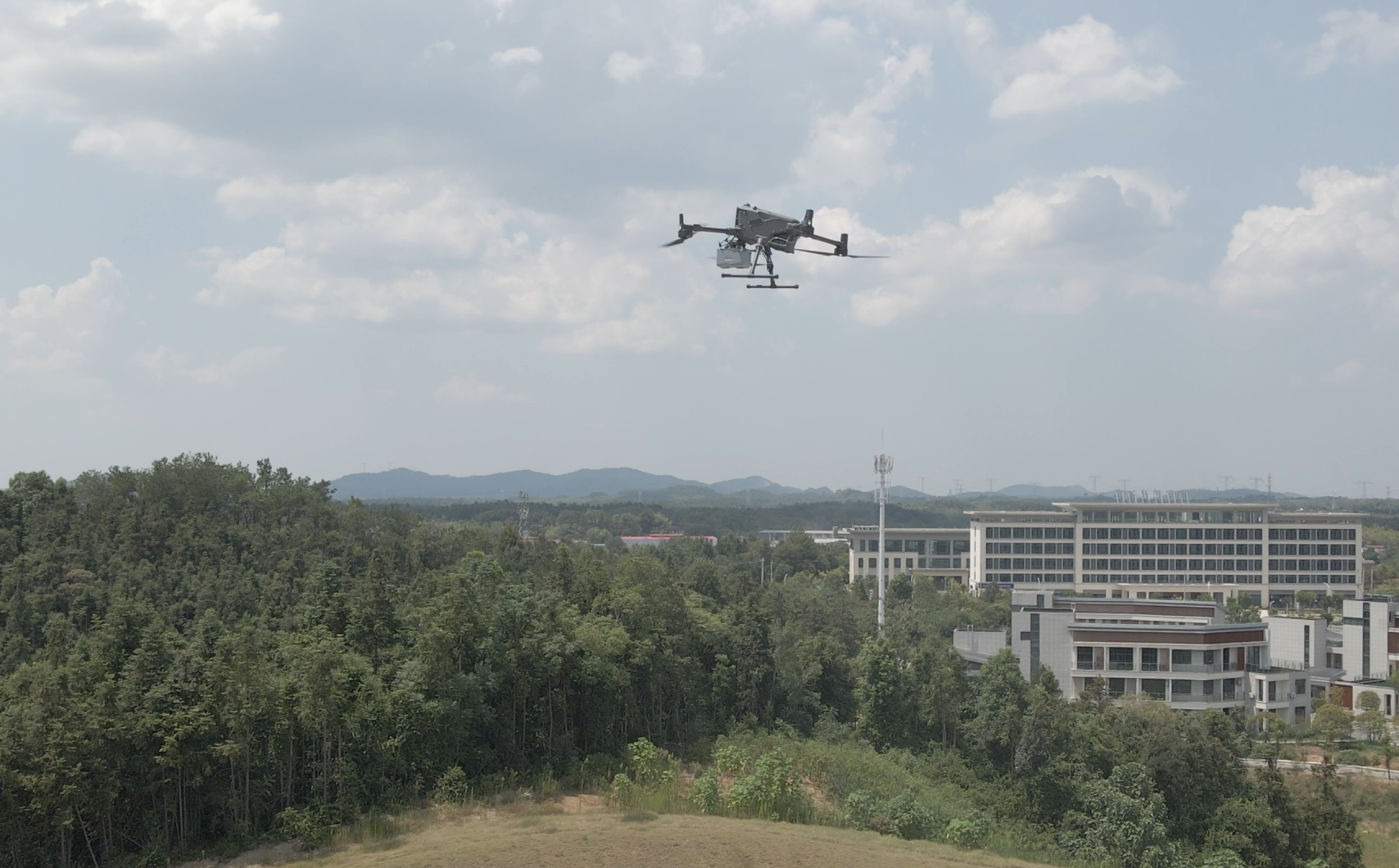
Platform: DJI M400 (long endurance, high payload).
Payload: FT-mini LiDAR (lightweight, integrated point cloud and imagery).
Flight altitude: 200 m | Point density: 18 pts/m² | Scan frequency: 300 kHz | Operation time: 26 minutes.
Project Execution & Results
Fieldwork flight: Completed data acquisition in a single sortie; three ground checkpoints were set up for accuracy validation.
Data processing: Noise filtering, classification of point clouds, and generation of DEM and DSM.
Deliverables: High-density point cloud (.las format), high-precision DEM/DSM.
Application Value
Application | Description |
Design support | Fault line layers can be directly imported into design software, avoiding re-surveying. |
Engineering efficiency | Reduced field surveying cycle to less than 20% of traditional methods. |
Cost saving | Reduced expenses for traffic control, labor, and on-site safety. |
Risk reduction | Remote flight + automated processing replace manual work near traffic. |
The DJI M400 +FT-mini LiDAR aerial survey solution demonstrated great value in highway reconstruction projects. The acquired 3 cm-level precision point cloud met survey and design requirements, providing reliable data support for smooth project implementation. This highlights how advanced technology brings cost reduction, efficiency improvement, and enhanced safety to traditional infrastructure projects.