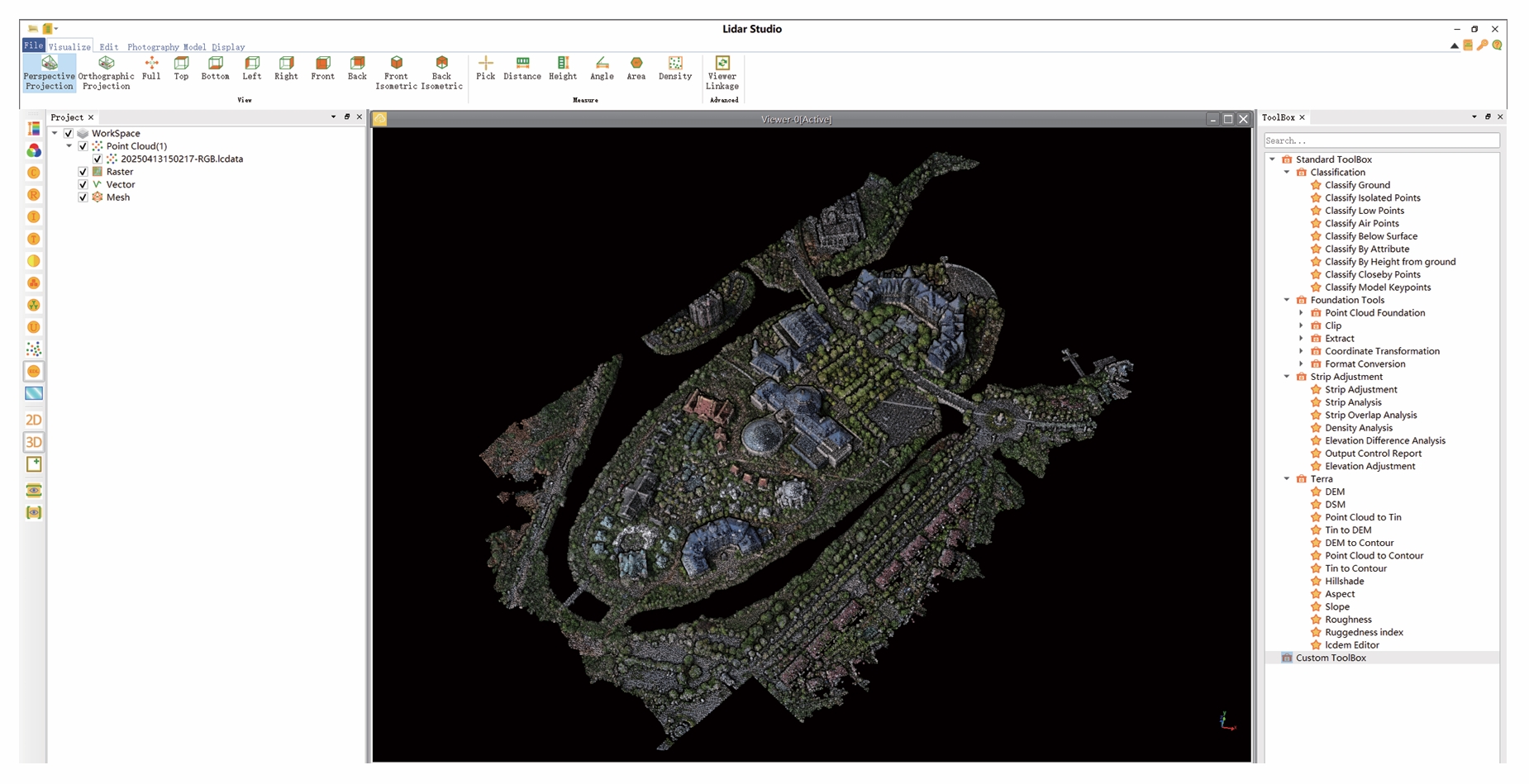
LidarStudio is a self-developed point cloud data processing and analysis software that utilizes cutting-edge computer graphics technology to achieve fast visualization and editing of massive point cloud data (supporting the rendering and processing of over 300G of point cloud data). It offers a rich set of editing tools and advanced point cloud processing algorithms for application in industries such as surveying, electric power, agriculture, and forestry.

Advantages
Massive data processing
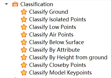
Point Classification:

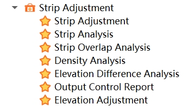
Strip Adjustment:

Point Cloud Processing:

LidarStudio mainly includes the following modules:
Data Management: Provides basic point cloud data management tools, including data format conversion for point clouds, as well as import, export, deletion, and other operations.
Display and Browsing: Provides a quick visualization interface and smooth browsing operations for massive point cloud files, along with rich rendering and display features.
Data Measurement: Offers basic data query and measurement functions, including interactive point selection, distance measurement, height measurement, angle measurement, area measurement, density measurement, and more.
Data Clipping: Offers interactive data clipping functions, including inner and outer clipping of any area and saving.
Data Editing: Provides interactive profile editing functions, allowing users to edit and save the category attributes of data blocks as needed.
Strip Adjustment Module: Provides a method to correct installation errors and checks installation errors to achieve strip adjustment.
Basic Tools Module: Offers various functions for point cloud pre-processing, including denoising, downsampling, merging, extracting, coordinate transformation, etc.
Classification Module: Provides point cloud ground point classification functionality.
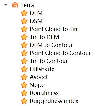
Terrain Module: Offers tools for generating 4D products. Through point cloud ground point extraction algorithms, ground points in complex environments can be precisely extracted, subsequently generating products such as DEM, DSM, contour lines, etc.
Installation Environment
CPU: Intel®Core™ i5/i7 Dual-Core Processor
Memory: Not less than 4GB
Graphics Card: NVIDIA dedicated graphics card recommended, video memory not less than 2GB
Operating System: Windows 10 (64-bit) / Windows 11 (64-bit)
It is recommended to run the software in high-performance graphics card mode.