

DJI Matrice 350 RTK
DJI Matrice 400
Other industrial UAV platforms supporting DJI SkyPort or external power supply
MT-MINI-ULTRA
Next-Generation Lightweight UAV LiDAR Mapping System
Lightweight Design. Outstanding Performance.
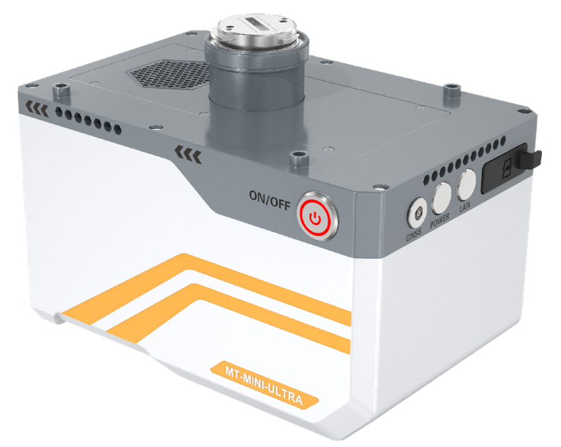
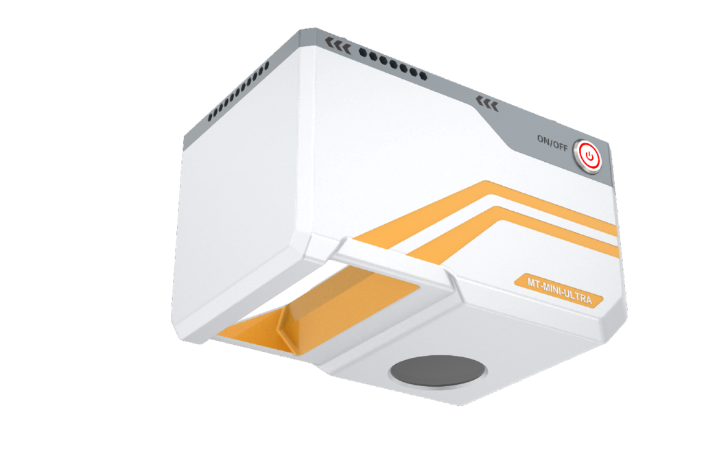
MT-MINI-ULTRA is a next-generation lightweight UAV LiDAR mapping system designed for high-precision aerial surveying and mapping. Integrating a high-performance LiDAR scanner, a high-precision GNSS/INS navigation system, and a high-resolution aerial metric camera into a compact and lightweight system, it delivers long-range measurement, high-density point cloud acquisition, and survey-grade positioning accuracy.
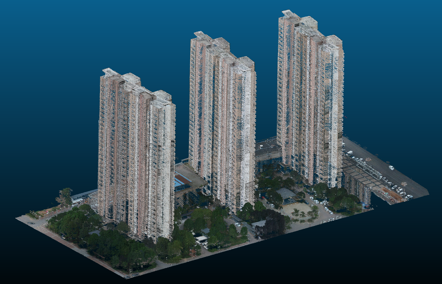
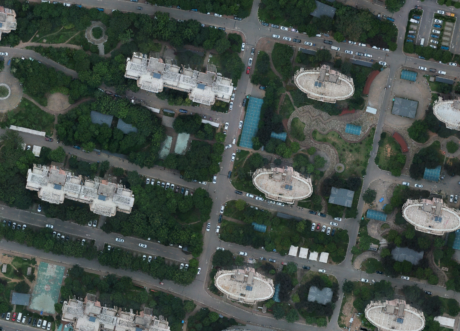
Supporting scanning at three different angles, MT-MINI-ULTRA significantly enhances point cloud acquisition for vertical structures while maintaining an 80° lateral field of view. It effectively reduces occlusions caused by buildings, bridges, vegetation or other obstacles, resulting in more complete and denser point cloud data, providing high quality data for topographic mapping, digital twin construction, urban 3D modeling, power line inspection, forestry survey, and other professional applications.
Specifications
| System Parameter | Weight | 1.3kg |
| Dimensions | 179*116*106.9mm (L*W*H) | |
| System Accuracy | Horizontal 5cm;Elevation 5cm | |
| Operating Temperature | -20℃~ +50℃ | |
| Light Condition | Natural Environment | |
| Humidity | Non-condensing | |
| Protect Level | IP64 | |
| Storage Temperature | -20℃~ +50℃ | |
| Power Supply Input Voltage | 24VDC(20V~30V input range) | |
| Power Consumption | 40W | |
| Laser Scanner | Laser Class | Level 1 |
| Laser Wavelength | 1535nm | |
| Beam Divergence | 0.5mrad | |
| Measurement Range | 10~1450m@80% | |
| Laser Pulse Repetition Rate | 100k~1000K | |
| FoV | 80° | |
| Scanning Angles (Heading) | 0° ,10°, -10° | |
| Angular Measurement Resolution | 0.001° | |
| Ranging Method | ToF | |
| Scan Rate | 60~300 lines/sec | |
| Repeatability Accuracy | 5mm@100m(1σ) | |
| Number of Returns | 7 times (typical value) | |
| Echo Signal Intensity | 8bit (Radiometric Calibration) | |
| POS | Attitude Accuracy | Roll/pitch:0.005° |
| Heading:0.01° | ||
| Horizontal Positioning Accuracy | 0.01m | |
| Vertical Positioning Accuracy | 0.02m | |
| Aerial Camera | Pixels | 45MP |
Key Features
Multi-angle Scanning · Enhanced Facade Data Capture
Supporting scanning at three different angles, MT-MINI-ULTRA significantly improves point cloud acquisition of building facades, bridges, slopes, and other vertical structures. While maintaining an 80° lateral field of view, it effectively reduces occlusions caused by buildings and vegetation, providing more complete point cloud coverage, offering high-quality and rich data for 3D modeling in complex environments.
Integrated Lightweight Design · Flexible Deployment
The LiDAR scanner, GNSS/INS navigation system, high-resolution aerial metric camera, and data storage unit are seamlessly integrated into a single compact unit weighing only 1.3 kg. Compatible with DJI Matrice 350 RTK, DJI Matrice 400, and other industrial UAV platforms, MT-MINI-ULTRA enables rapid deployment and efficient field operations to meet aerial surveying requirement under various application scenarios.
Long-Range Measurement · Accurate and Reliable
Equipped with a 1535 nm laser, MT-MINI-ULTRA provides a maximum measurement range of 1450 m with repeatability accuracy better than 5 mm at 100 m. It delivers stable and reliable data acquisition capability for large-area terrain mapping, mountainous area terrain mapping, corridor surveying, and infrastructure inspections.
High-Performance Scanning · Richer Point Cloud Details
With a pulse repetition rate of up to 1000 kHz, an 80° lateral field of view, and multi-angle scanning, MT-MINI-ULTRA captures denser and more complete point cloud data, providing finer details for building facades, slopes, and other complex structures, laying solid data support for high-precision 3D modeling.
Multi-Return Capability · Accurate Terrain Representation
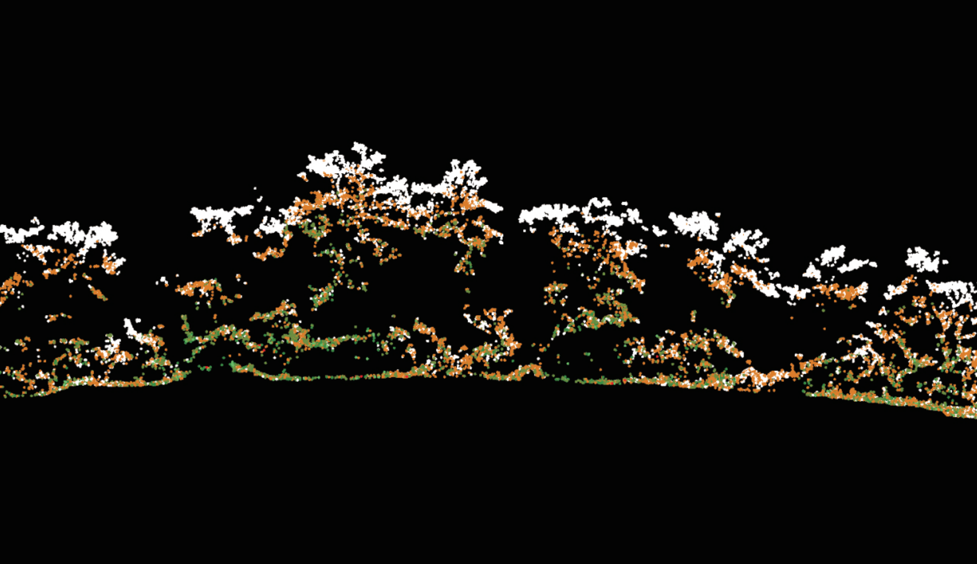
Supporting up to 7 returns, the system effectively penetrates vegetation to accurately capture terrain data under forest canopies, meeting data collection requirements for forestry surveys, natural resource investigations, topographic mapping, and ecological monitoring in complex environments.
Survey-Grade Accuracy · Stable and Reliable Data
The built-in high-precision GNSS/INS navigation system provides centimeter-level positioning accuracy and stable attitude calculation. Combined with the high-performance LiDAR sensor, MT-MINI- ULTRA delivers stable and reliable point cloud data for professional surveying, digital twin applications, and infrastructure inspections.
Application Fields
Topographic Mapping
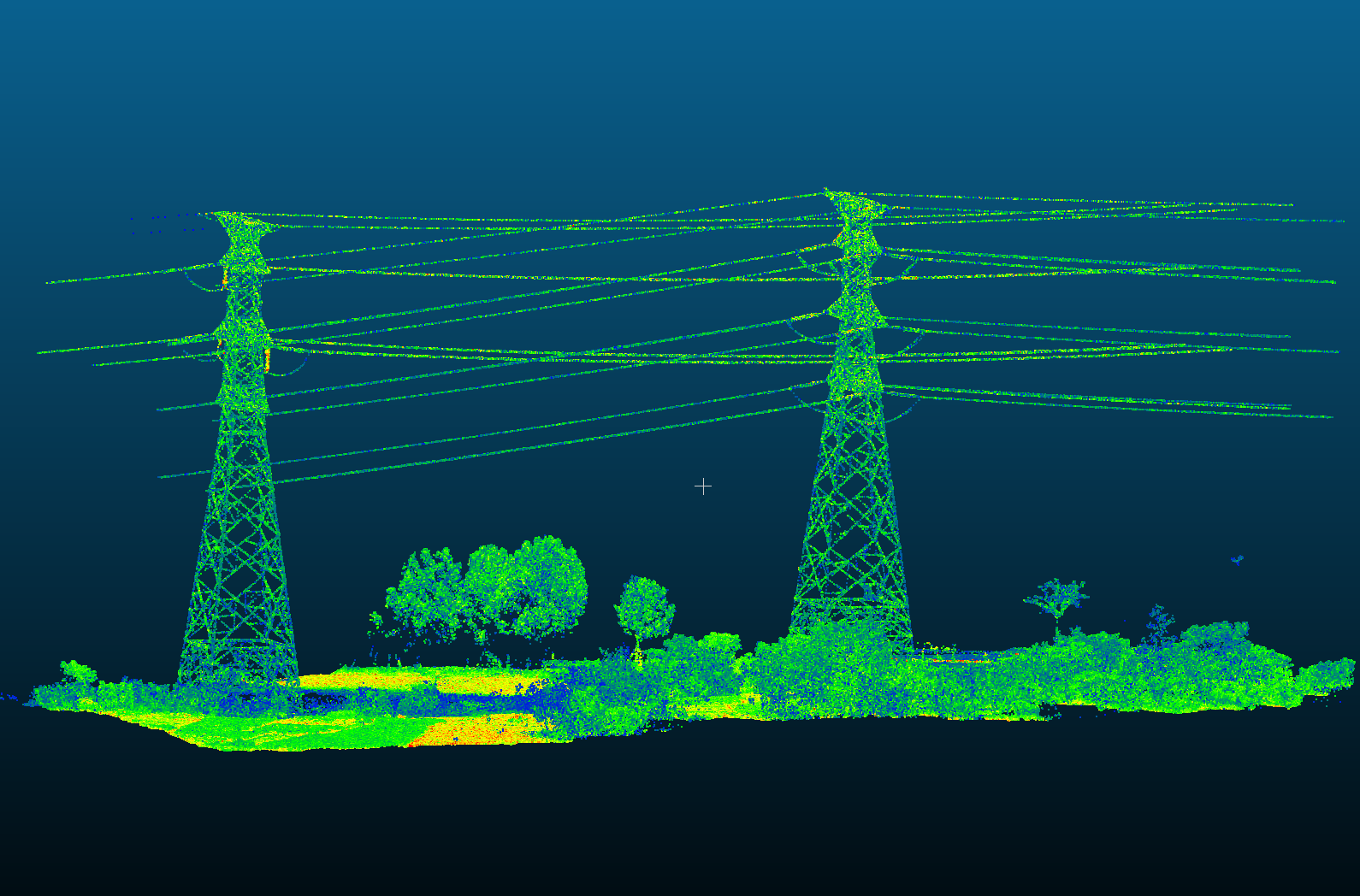
Power Line Inspection
Forestry Survey
Mining Survey
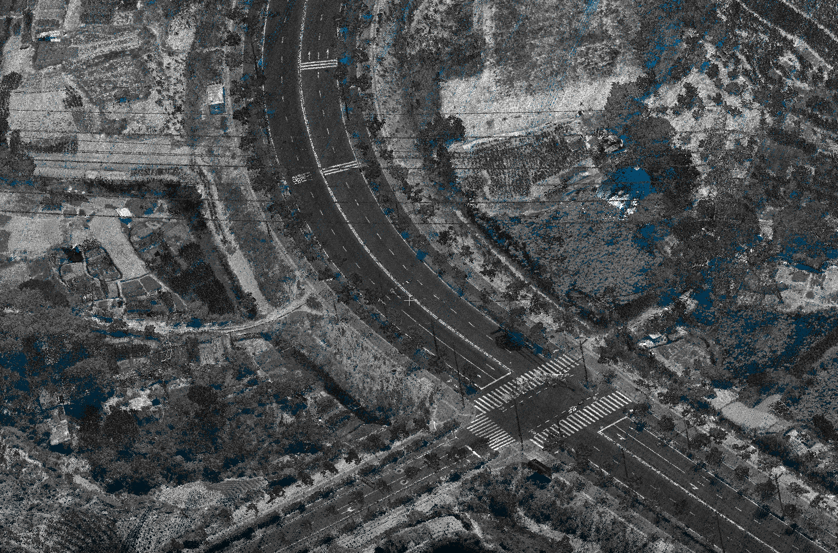
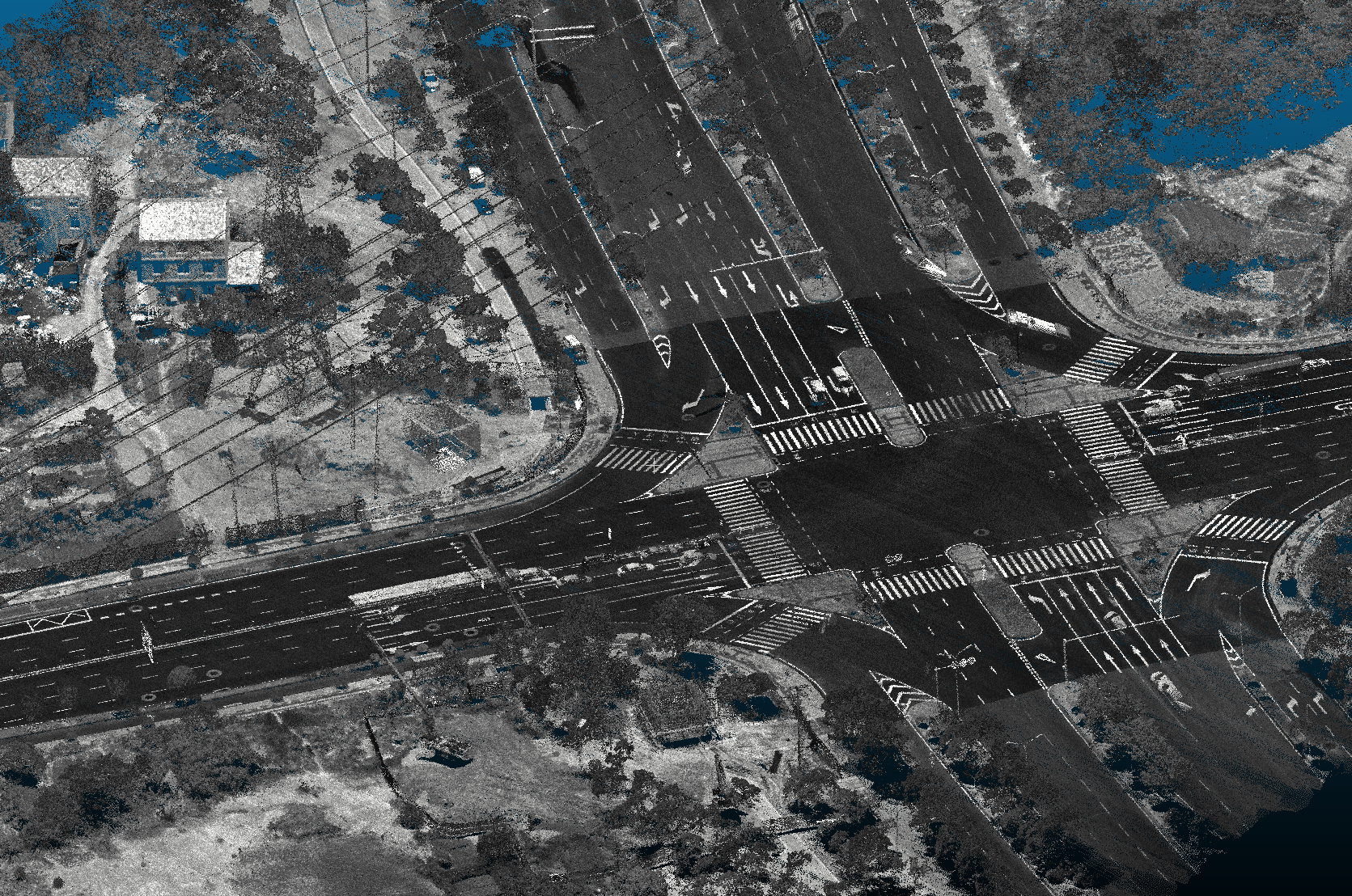
Transportation&Corridor Mapping
Compatible UAV Platforms
MT MINI ULTRA is compatible with a variety of industrial UAV platforms, enabling flexible deployment and efficient operation.