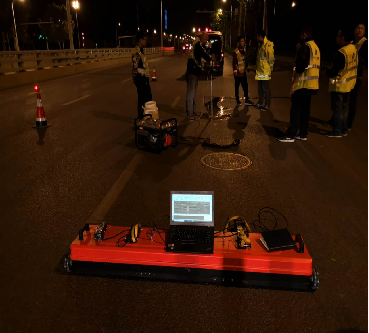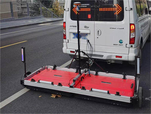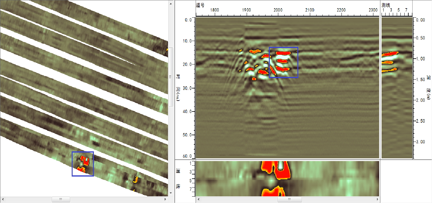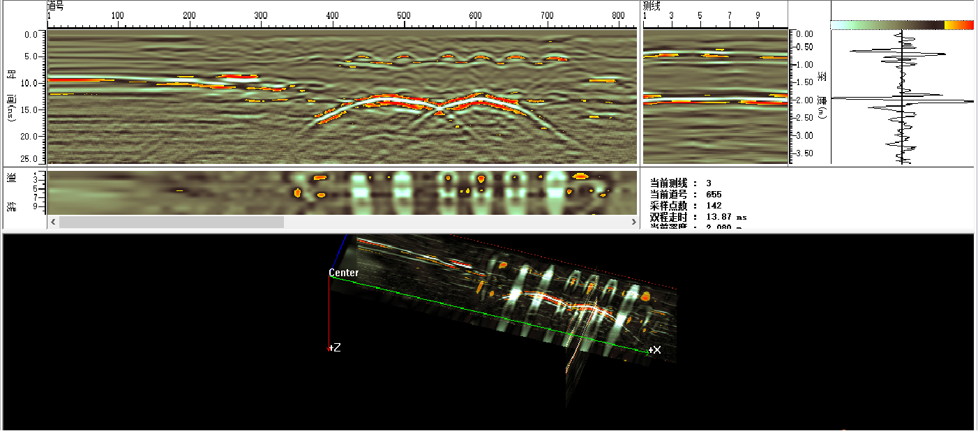
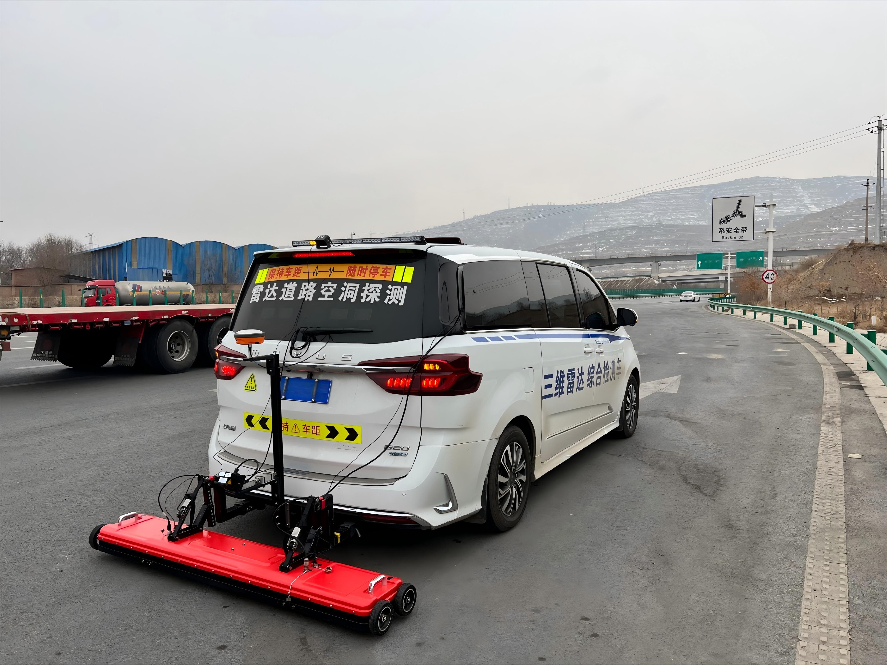
The 3D GPR array data acquisition system includes radar array antennas (integrated host), GPS precise positioning system, control unit, engineering vehicle, etc. It synchronously collects various data information such as 3D ground penetrating radar images, image coordinate positions, and markers, and integrates them into the same dataset. This system can conduct comprehensive and full-coverage survey and detection of urban roads. By adopting the 3D GPR system, geophysical exploration technicians can analyze and determine the location, morphology, and hazard level of each underground anomaly through radar image "slices" from different directions.
Technical advantages of 3D Array Radar
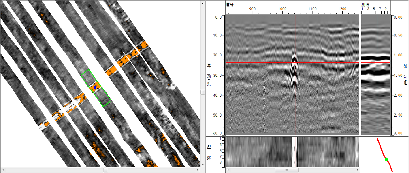
Full-coverage detection, covering the entire physical width of the equipment without any gaps.
High efficiency with fast detection speed, high data acquisition efficiency, good consistency in profile data, and even intervals.
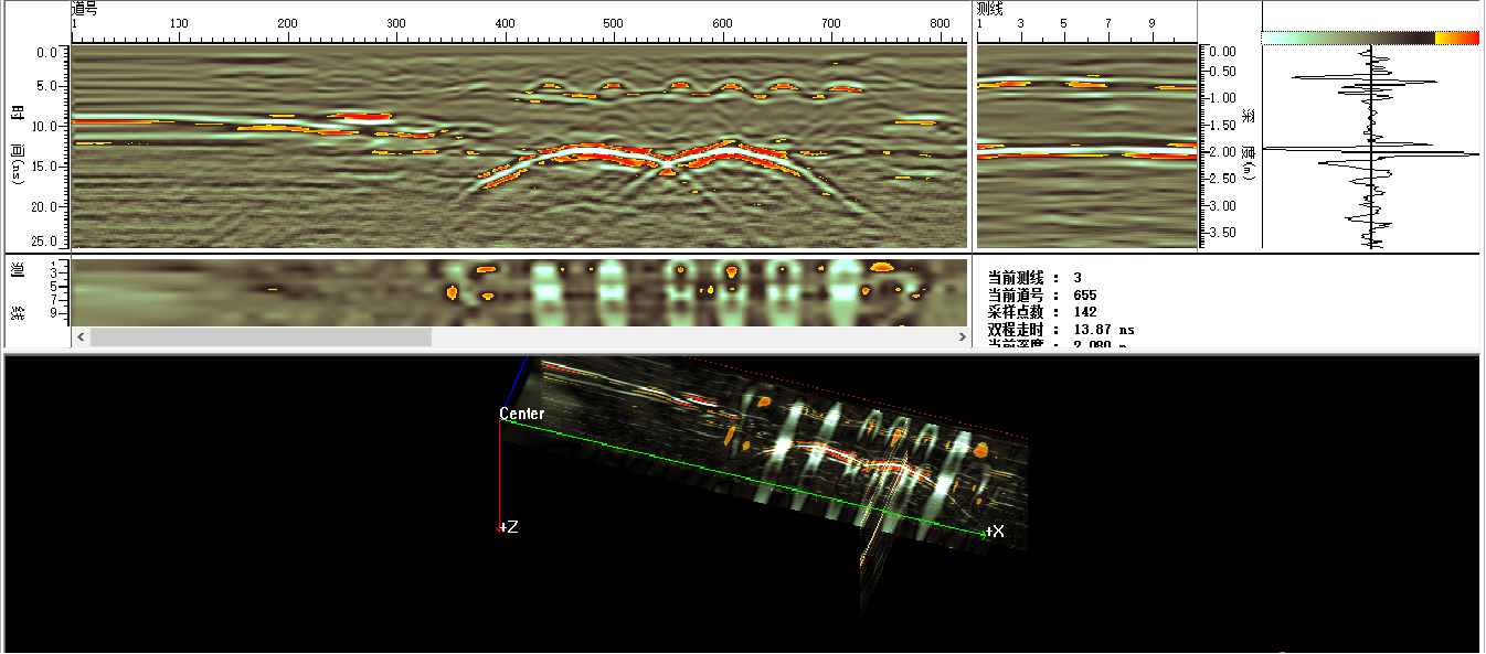
Direct 3D imaging, providing three-dimensional and intuitive results with accurate interpretation.
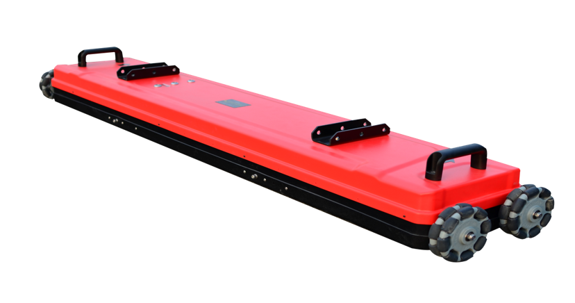
Simple installation and high integration of equipment. The main control and antenna array are integrated with a small size, light weight, and low power consumption. The installation structure is simple, allowing for quick installation and disassembly.
Simple external interfaces, including only WLAN, power supply, GPS, and ranging interfaces. The host computer is just a laptop, making it easy to use with fewer cables.
MIMO array antenna design with high antenna density. Compared to multi-channel radars, it achieves big data, supports real-time 3D imaging, and facilitates result interpretation.
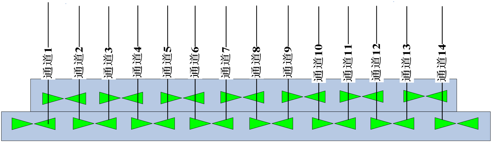
The 3D array radar antenna arrangement adopts a MIMO architecture design, enabling high-density detection and high-precision imaging of roads.
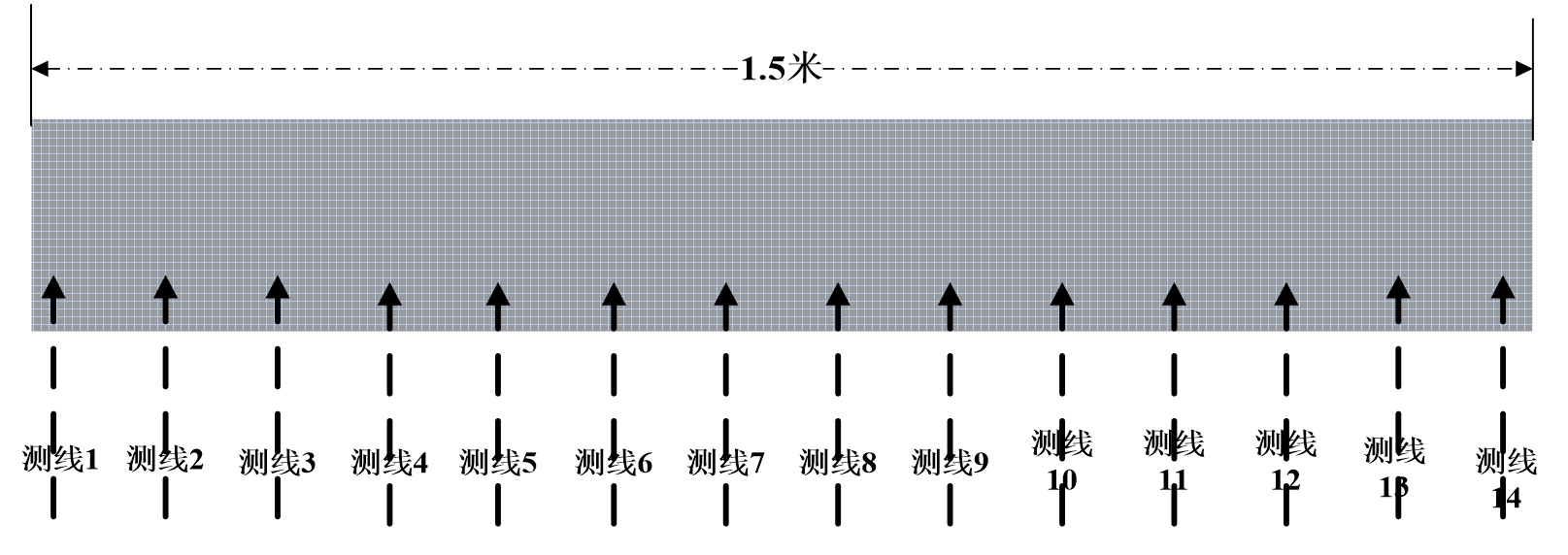
The detection lines of the 3D array radar:high density, even spacing, and good data consistency
Specifications
LGPR 3D-200AT8 | LGPR 3D-200AT16 | LGPR 3D-900AT14 | |
System Size | 210cm×45cm×20cm | 210cm×150cm×50cm | 150cm×28cm×14cm |
Array Form | MIMO | ||
Number of channels | 8 | 16 | 14 |
System Weight(including battery) | ≤30kg | ≤70kg | ≤20kg |
Power Consumption | ≤20W | ≤80W | ≤20W |
A/D | 16bit | 16bit | 16bit |
Supply Voltage(external lithium battery) | 9V-14V | 9-14V | 9-14V |
Detection Depth | ≥5m(depend on medium) | ≥5.0m(non-high attenuation medium) | ≥1m(depend on medium) |
Detection Result | 2D detection data, 3D imaging slices | ||
Operating Temperature | -20℃~+50℃ | -20℃~+50℃ | -20℃~+50℃ |
Storage Temperature | -40℃~+60℃ | -40℃~+60℃ | -40℃~+60℃ |
Applications
Airport runway inspection: Detection of airport runway defects and voids, as well as quality inspection and assessment of runways.
Highway inspection: Detection of structural layer defects in highways, and inspection and investigation of subgrade conditions.
Municipal road inspection: Detection of road defects, and imaging of road gravities, voids and other defects.
Pipeline detection: Comprehensive pipeline survey and three-dimensional imaging of pipelines under roads.