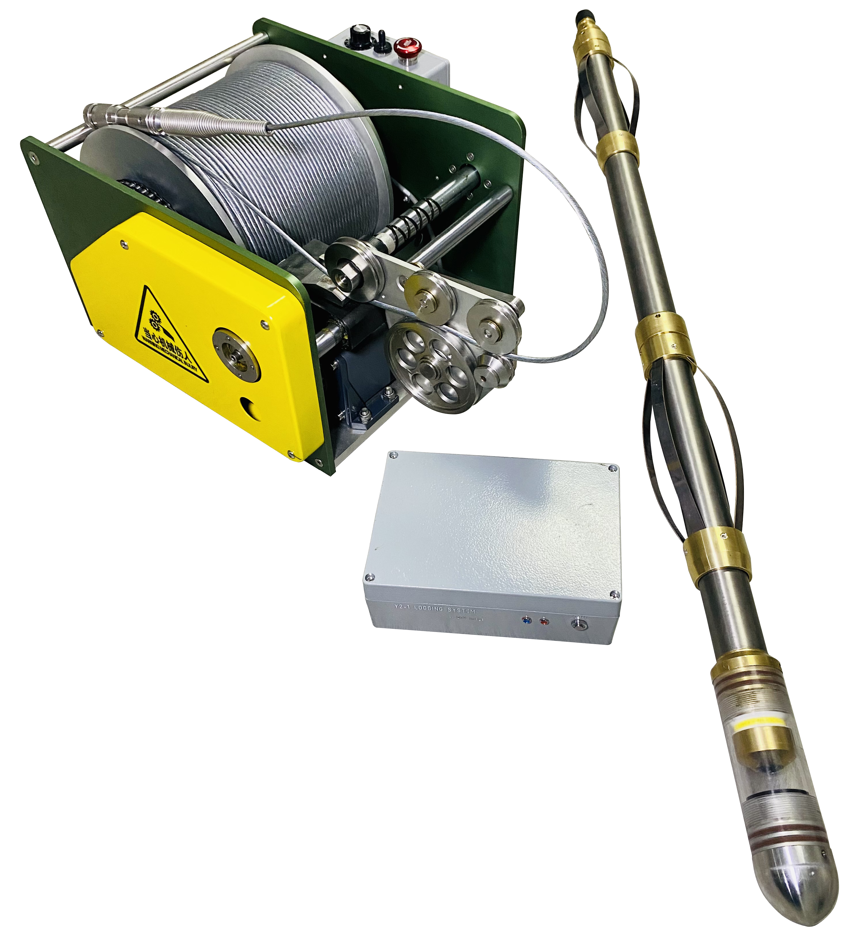
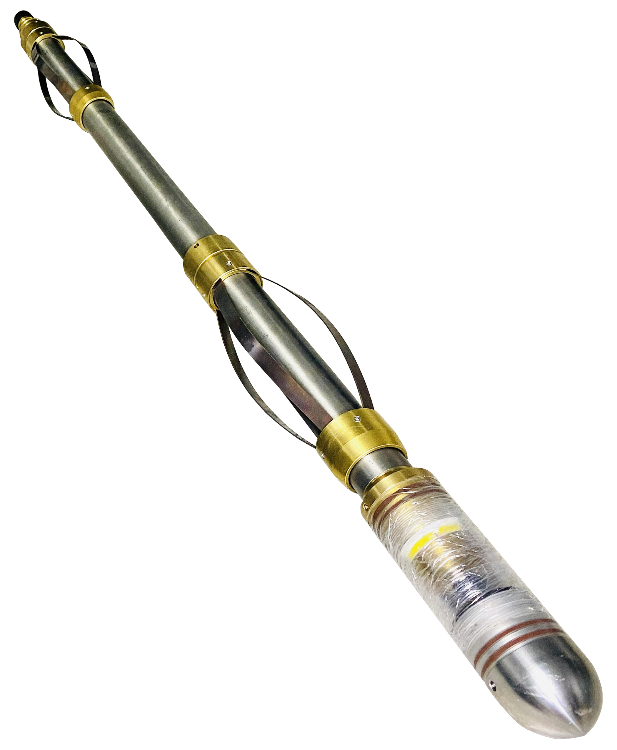
Digital optical downhole imaging camera head
Ground data acquisition and control unit
Logging winch and cable system
Data processing and interpretation software
Probe diameter: 50 mm
Probe length: 1.2 m
Weight: 7 kg
Housing material: Titanium alloy / Non-magnetic copper
Maximum operating temperature: 70 °C
Maximum operating pressure: 20 MPa
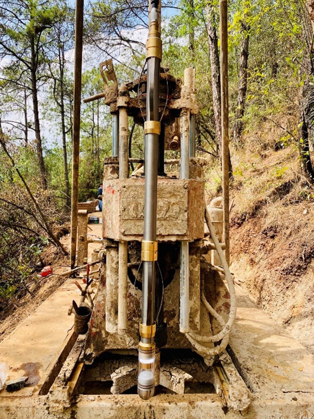
Applicable well conditions: Dry wells, clear-water wells
Image sensor: Industrial-grade CMOS
Color mode: 24‑bit RGB true color
Horizontal resolution: 360 / 540 / 720 / 900 / 1080 / 1260 / 1440 pixels
Vertical resolution: Determined by logging speed
Applicable borehole diameter: 60 ~ 600 mm
Orientation sensors: Tri-axial magnetometer + tri-axial accelerometer
Single-core, four-core, and multi-core armored cables
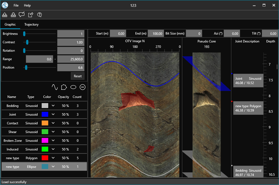
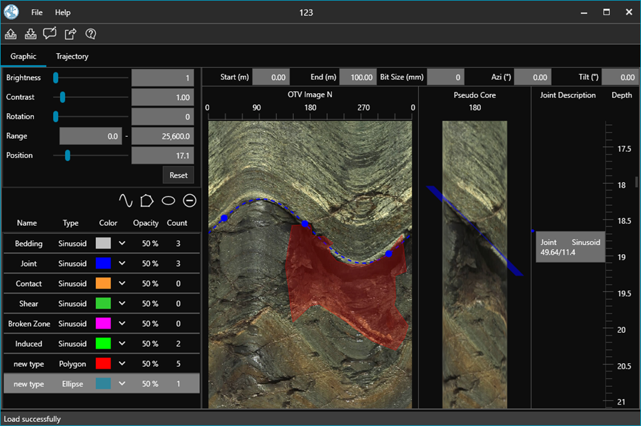
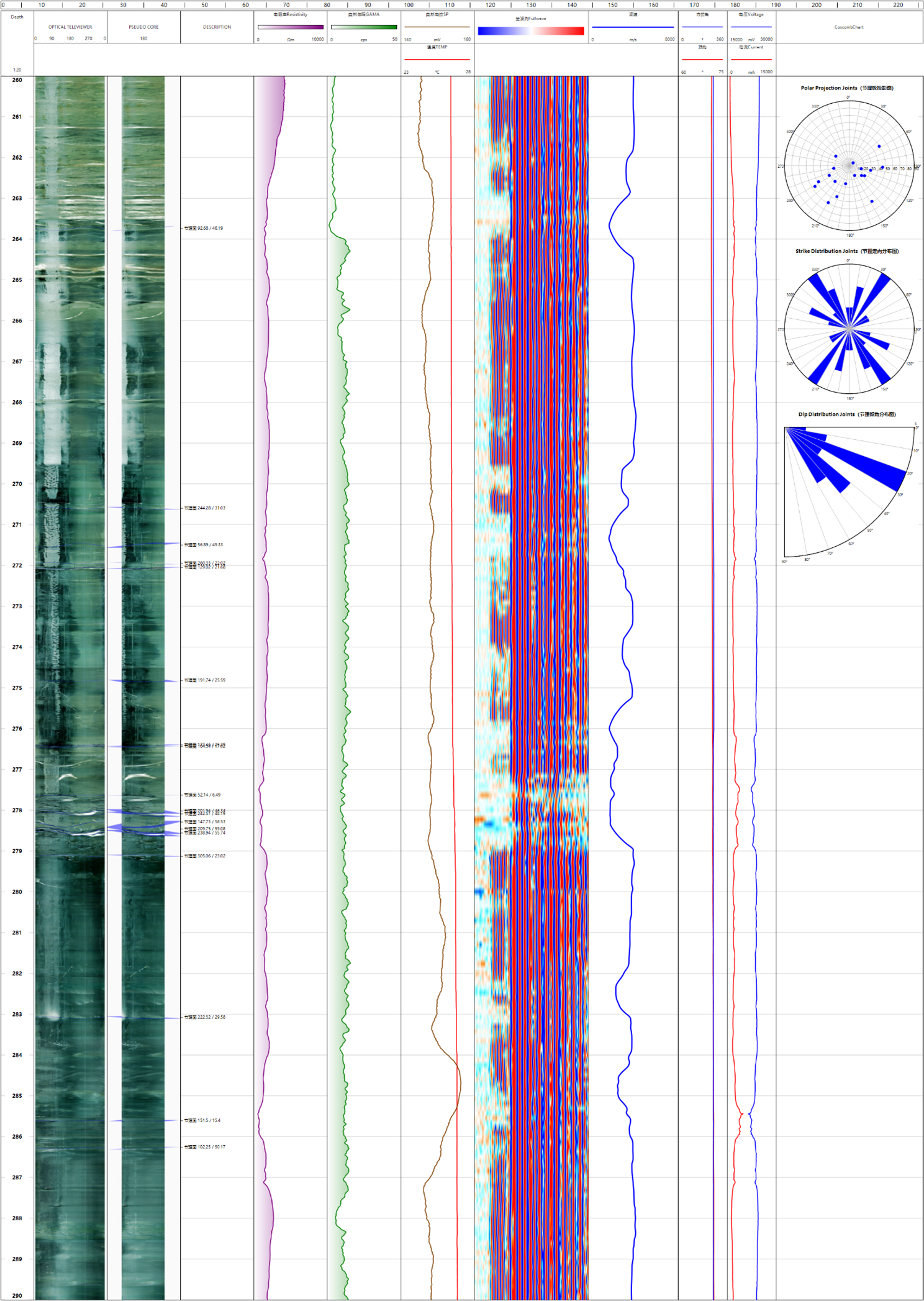
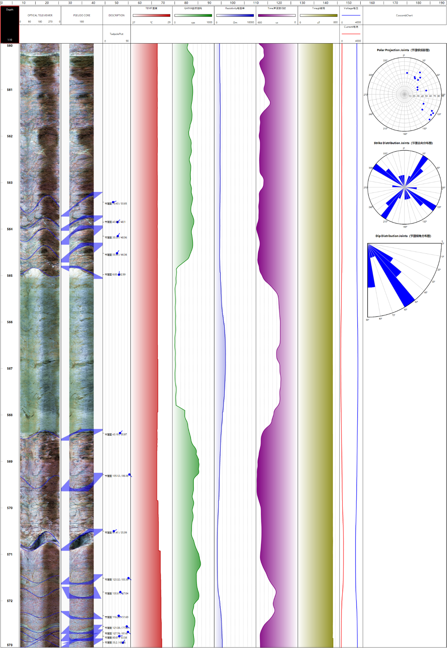
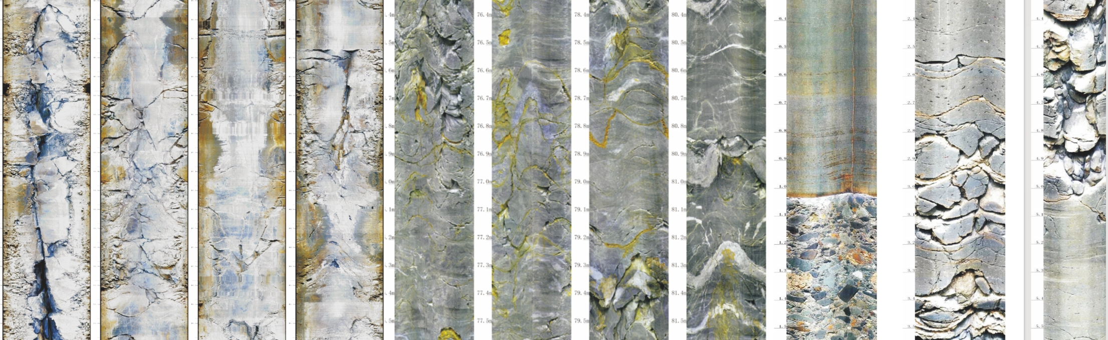
360° digital borehole wall images for the entire well section
Borehole fracture and joint identification results
Digital core images and core positioning results
Formation dip and thin-layer analysis results
Oriented structural data
Borehole wall video data for the entire well section (real-time videos and recorded playback files)
Geological and mineral exploration
Engineering geological investigations
Hydrogeological and borehole analysis
Fracture and structural feature studies
Borehole quality and structural assessment
The Linventix Optical Logging System LBC-Y2 is a digital optical borehole camera solution designed for geological exploration, engineering investigation, and mineral surveys.
The system integrates a high-precision wide-angle optical imaging camera head with orientation sensors and a ground data acquisition system. It can capture continuous 360° borehole wall imaging and generate complete unwrapped borehole wall images, providing an intuitive and reliable data foundation for geological structure interpretation, fracture analysis, and lithology identification.
The system is suitable for dry and clear-water borehole conditions, compatible with various standard logging cable configurations, and can operate stably in different borehole diameters, meeting the high-resolution borehole wall imaging requirements for multiple types of boreholes.
System Components
Main Features
360° Full Borehole Wall Imaging
Equipped with a 360° infinite-focus optical system, the probe achieves full borehole wall coverage and generates continuous, complete unwrapped borehole wall images, avoiding information loss caused by traditional point-based or partial imaging methods.
High‑Resolution Optical Images
Equipped with an industrial-grade high-resolution CMOS image sensor, it supports true-color imaging. Borehole wall details are clearly visible, allowing intuitive visualization of bedding, fractures, and lithological changes.
Adaptive Borehole Diameter Design
It supports stable imaging under various borehole diameter conditions, is applicable to a wide range of borehole diameters, meeting the requirements of different exploration and engineering boreholes.
Stable and Reliable Downhole Light Source
With build-in high-brightness white LED ring light source, it can still capture clear and uniform borehole wall images in environments without natural light.
Simultaneous Imaging and Orientation Acquisition
Imaging data is collected simultaneously with azimuth and inclination information, enabling oriented borehole wall imaging and providing a basis for subsequent structural analysis and quantitative interpretation.
Technical Specifications
Logging Probe
Operating Environment
Imaging Performance
Measurement Capability
Cable Support
Data Outputs
The system can generate complete 360° digital borehole wall images, supports real-time video preview and recorded video playback.
After processing with interpretation software, the following results can be generated:
Typical Applications